
Lithology of Gas-Bearing Interval
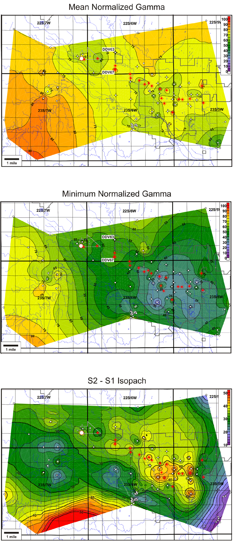
Natural gamma ray serves as an indicator of lithology when substantiated with nearby core or outcrops. The gamma-ray logs in the Hutchinson-Yaggy study area were normalized to vary from 0 (salt) to 100 (shale), and variations in lithology of the 3-finger dolomite interval were investigated by looking at maps of mean normalized gamma ray and minimum normalized gamma ray.
Mean gamma shows the average shaliness of the interval and indicates that, in general, the 3-finger dolomite is cleanest along a northwest-southeast-trending corridor from Yaggy to Hutchinson, including the city proper, with considerable increase in shaliness to the southwest and minor increase in shaliness to the northeast.
Minimum gamma, which identifies the shaliness of the cleanest dolomite within the interval (the top dolomite in all but a few wells), shows an even more dramatic decrease beneath Hutchinson and along the corridor northwest of the city toward Yaggy. The areas of lowest gamma ray in the 3-finger dolomite within and near the city are deemed more susceptible to fracturing and possibly have existing natural fractures that could serve as gas conduits, because the parting pressures of these fractures could be considerably lower than the pressure needed to create new fractures.
The location of the cleanest dolomite in the minimum gamma map of the 3-finger interval corresponds closely to a location of thick salt in the S2-S1 isopach map, suggesting that this area of preserved salt was a slight topographic high during the time of deposition of the 3-finger dolomite. This shallowing may have led to decreased turbidity and encouraged greater carbonate productivity.
Last updated June 2004
http://www.kgs.ku.edu/PRS/publication/2004/AAPG/NG_Migration/P3-02.html