
Possible Thermogenic and Biogenic Orgins of Kansas Coalbed Gas
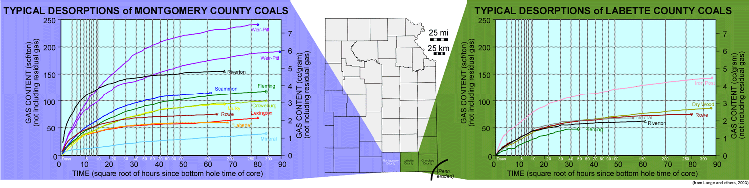
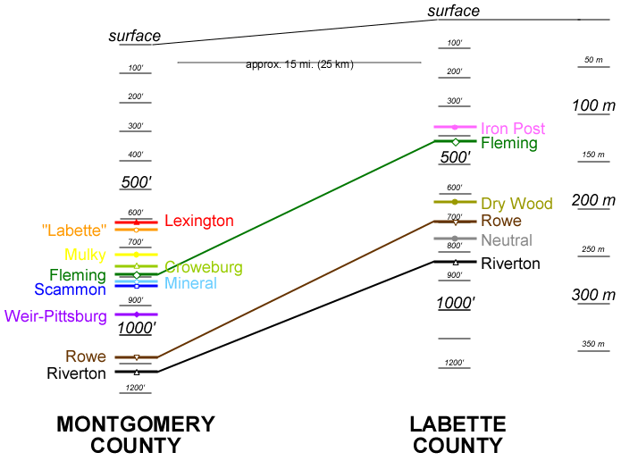
The desorption diagrams above are from two wells in adjacent counties in the Cherokee basin. The deepest coals in Montgomery County (to the west) register gas contents from 250 to 300 scf/ton. The same coals in Labette County (to the east) are buried less deeply, and they have gas contents considerably less than the Montgomery County coals. However, the Iron Post coal at 382 ft (116 m) depth in the Labette County well has an unexpectedly large gas content (>100 scf/ton), exceeding that of the deeper coals. A microbial or mixed thermogenic-microbial origin for this gas is suggested. Pennsylvanian coal-bearing units crop out at the surface in Cherokee County (the county immediately east of Labette County). Downdip movement of fresh water from the outcrop may augment biogenic production of coalbed gas in shallow coals along the eastern flank of the Cherokee and Forest City basins. A possible consequence to this model is that separate thermogenic and biogenic production fairways in the same coal may be present. The thermogenic fairway would be deeper in the basin where there is sufficent burial and confining pressure. The biogenic fairway would be updip and closer (and likely parallel) to the outcrop where basinal brines would be diluted by meteoric waters carried downdip from the outcrop.
Click on the above image for greater detail
Last updated May 2004
http://www.kgs.ku.edu/PRS/publication/2004/AAPG/Coalbed/P3-02.html