
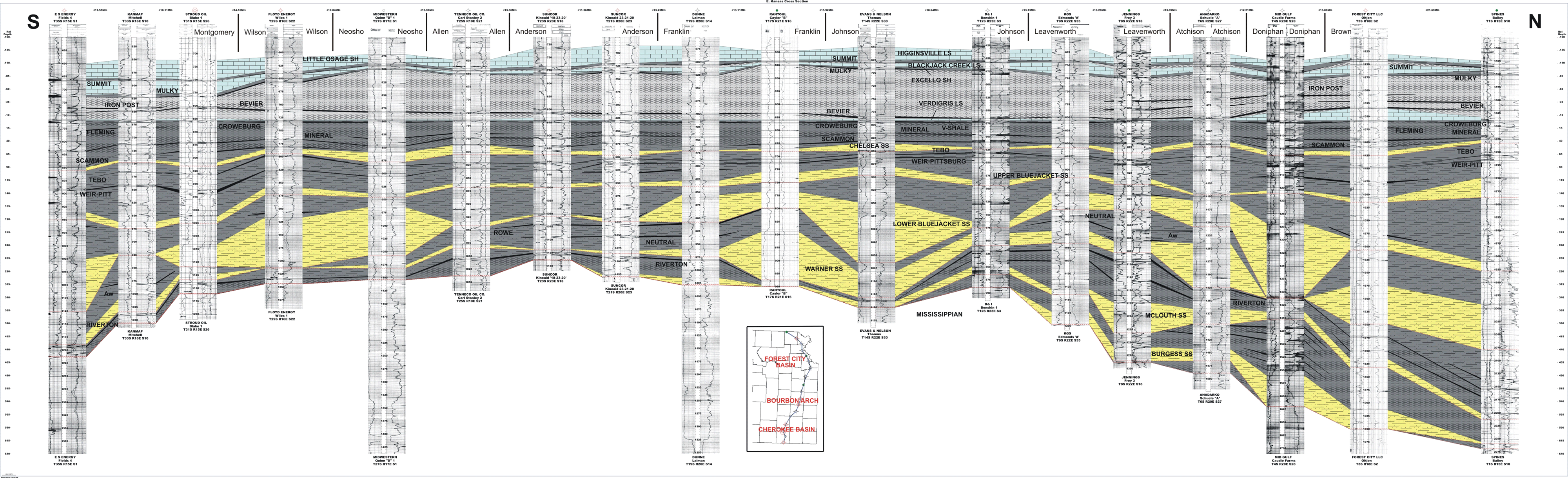
 Generalized north-south stratigraphic cross section (datum on the V-shale)
illustrates the regional extent and thickness of major Cherokee and Marmaton
(Atokan-Desmoinesian) coals and other units through eastern Kansas from the
Oklahoma to Nebraska borders. Evidence of earlier accommodation development
in the Forest City basin is observed from older deposits including numerous
coal seams underlying the Riverton coal. The Riverton coal is the oldest regionally
continuous coal in eastern Kansas. Coals become thinner and less extensive
over the Bourbon arch and thicker and more extensive northward into the Forest
City Basin and south into the Cherokee Basin. (Click on above image to display
more detail.)
Generalized north-south stratigraphic cross section (datum on the V-shale)
illustrates the regional extent and thickness of major Cherokee and Marmaton
(Atokan-Desmoinesian) coals and other units through eastern Kansas from the
Oklahoma to Nebraska borders. Evidence of earlier accommodation development
in the Forest City basin is observed from older deposits including numerous
coal seams underlying the Riverton coal. The Riverton coal is the oldest regionally
continuous coal in eastern Kansas. Coals become thinner and less extensive
over the Bourbon arch and thicker and more extensive northward into the Forest
City Basin and south into the Cherokee Basin. (Click on above image to display
more detail.)e-mail : webadmin@kgs.ku.edu
Last updated May 2004
http://www.kgs.ku.edu/PRS/publication/2004/AAPG/Coalbed/P2-01.html