 |
|
Kansas Geological Survey Open-file Report 2003-68 |
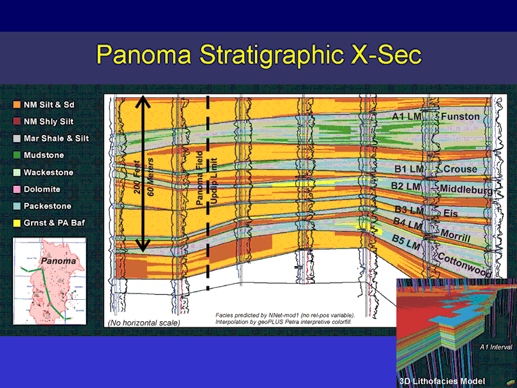
Shown here is a west-east stratigraphic cross-section of the Council Grove through the Panoma field constructed with geoPlus Petra’s ® interpretive color fill function. The northwest to southeast stratigraphic cross-section illustrates the large-scale lithofacies and depositional relationships in the Panoma Field. The updip limit to the Panoma coincides with thinned marine carbonate intervals and reciprocally thicker nonmarine silts and shaly silts. The lateral and vertical relationships of the eight lithofacies is illustrated but is not to be considered a true representation of the finer geometries due to the limitations of the software application used to create the section. A more accurate representation of the fine-scaled heterogeneity is illustrated in the 3D model output of the commercial modeling application shown in the lower right.
e-mail : webadmin@kgs.ku.edu
Last updated January 2004
http://www.kgs.ku.edu/PRS/publication/2003/ofr2003-68/slide17.html