 |
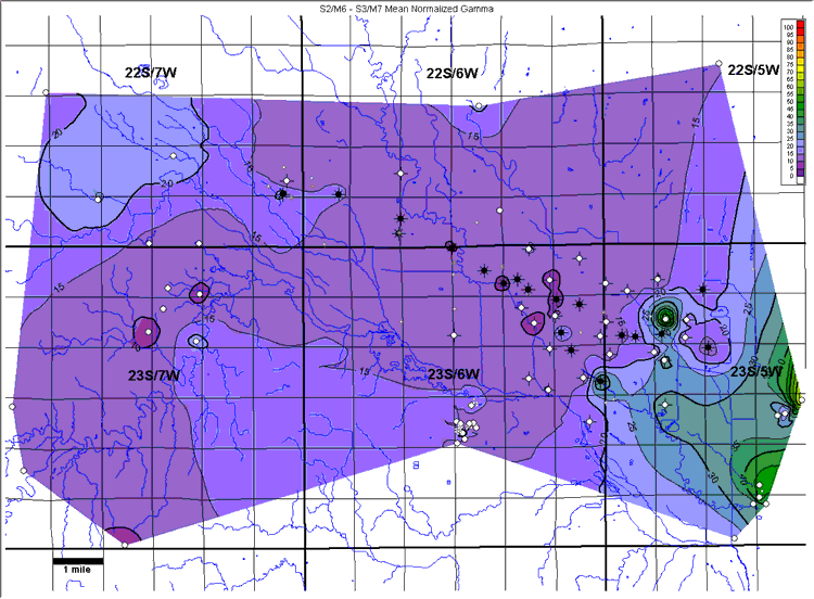
| Figure 6A. Mean normalized natural-gamma ray for the S2/M6 – S3/M7
interval, showing the facies change at the eastern edge of the study area.
Values are % shale. Contour interval = 5%. |
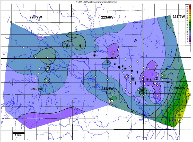 |
| Figure 6B. Mean normalized natural-gamma ray for the S1/M5 – S2/M6
interval, showing the facies change at the eastern edge of the study area.
Values are % shale. Contour interval = 5%. |
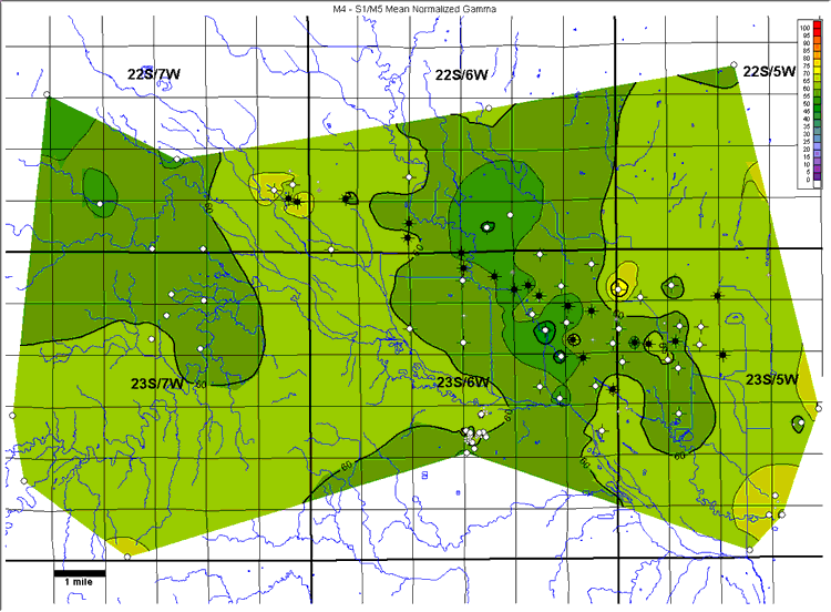 |
| Figure 6C. Mean normalized natural-gamma ray for the M4–S1/M5
interval. Values are % shale. Contour interval = 5%. |
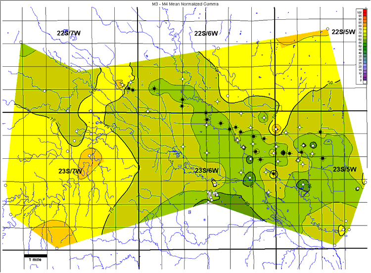 |
| Figure 6D. Mean normalized natural-gamma ray for the M3-M4 interval.
Values are % shale. Contour interval = 5%. |
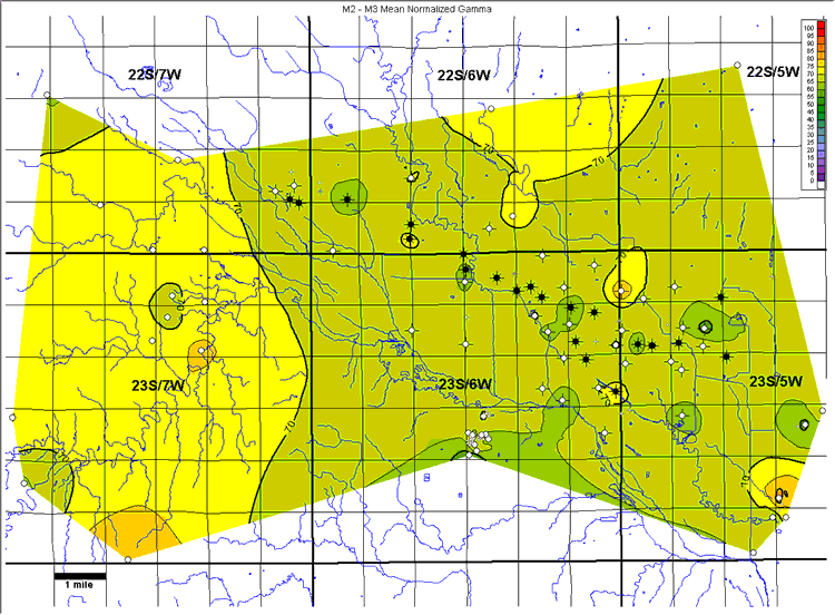 |
| Figure 6E. Mean normalized natural-gamma ray for the M2-M3 interval.
Values are % shale. Contour interval = 5%. |
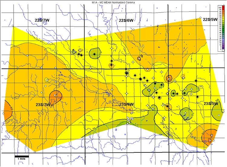 |
| Figure 6F. Mean normalized natural-gamma ray for the M1A-M2 interval.
Values are % shale. Contour interval = 5%. |
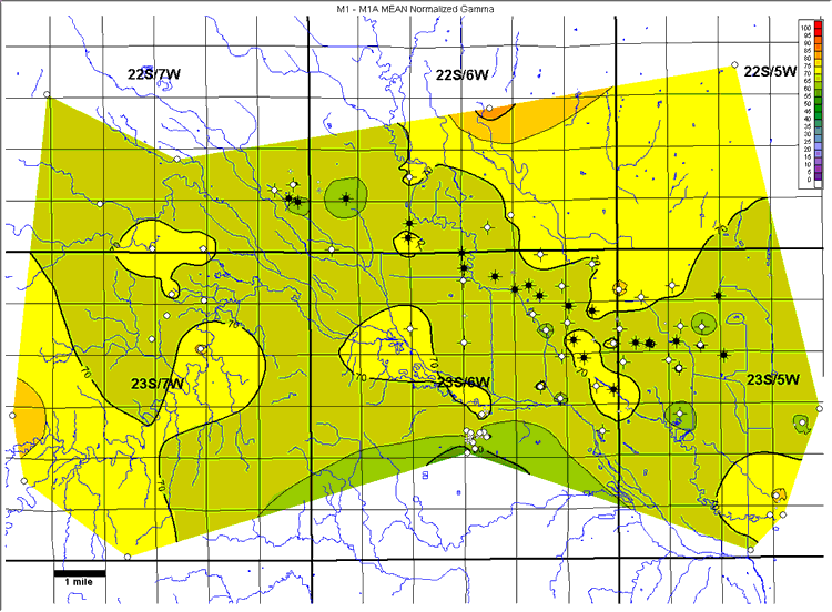 |
| Figure 6G. Mean normalized natural-gamma ray for the M1-M1A interval.
Values are % shale. Contour interval = 5%. |
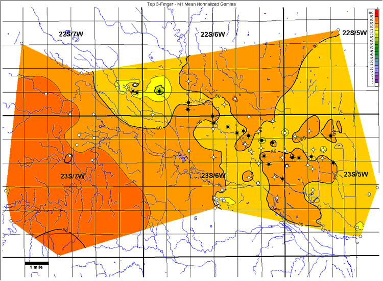 |
| Figure 6H. Mean normalized natural-gamma ray for the Top 3-finger dolomite-M1
interval. Values are % shale. Contour interval = 5%. |
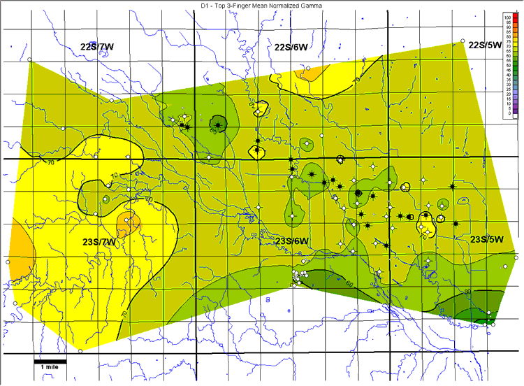 |
| Figure 6I. Mean normalized natural-gamma ray for the D1-Top 3-finger
dolomite interval. Values are % shale. Contour interval = 5%. |
Wells within the study area not used in generating these maps are displayed
in gray at half size.
