 |
|
Kansas Geological Survey Open-file Report 2003-57 |
Location
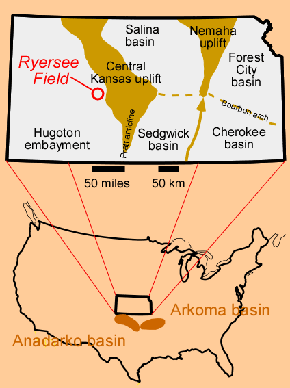
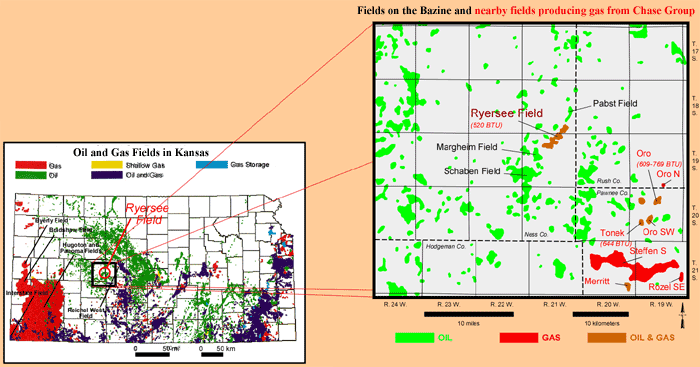
The Ryersee Field, in T.18S.-R.21W., is located on the northeastern flank of the Hugoton embayment of the Anadarko basin, on the northern end of the Bazine anticline. The Bazine Anticline is in southeastern Ness County, KS.
 |
|
| Ryersee Field is 65 miles (105 km) northeast of the giant Permian gas fields (i.e., Hugoton, Panoma) in the Hugoton embayment. | Ryersee Field is near the northern end of the Bazine anticline. Several oil fields are located along the 10-mile (16-km) crest of this structure. Low-BTU gas fields paying from the Chase Group 15 miles (24 km) southeast suggests low-BTU gas deposits in this region could be substantally extended. |
|
|
|
e-mail : webadmin@kgs.ku.edu
Last updated November 2003
http://www.kgs.ku.edu/PRS/publication/2003/ofr2003-57/P1-03.html