 |
|
Kansas Geological Survey Open-file Report 2003-26 |
 |
| Color key used for facies in maps, cross-sections, and line drawings. |
Paleogeography Map
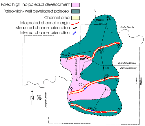
Map showing facies distribution early on in Merriam deposition. Outcrop locations shown in red are areas where channels are present, and rectangles indicate areas of closely-spaced data. Lines of cross-sections through the field area are also shown. Subsurface data from O’Connor (1977) was used as an aid in interpreting trends of channels.
|
|
|
e-mail : webadmin@kgs.ku.edu
Last updated May 2003
http://www.kgs.ku.edu/PRS/publication/2003/ofr2003-26/P1-04.html