
Arbuckle Reservoirs in Central Kansas: Relative Importance of Depositional Facies, Early Diagenesis and Unconformity Karst Processes on Reservoir Properties
Kansas Geological Survey
Open-file Report 98-55
|
|
Arbuckle Reservoirs in Central Kansas: Relative Importance of Depositional Facies, Early Diagenesis and Unconformity Karst Processes on Reservoir Properties |
Kansas Geological Survey Open-file Report 98-55 |
 Click
on the Back Button to return to the previous page. Click
on the Back Button to return to the previous page. |
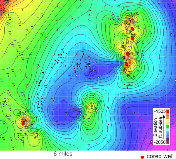
Structure maps for Rice and Ellsworth counties show
more than 500 feet of relief on the top of the Arbuckle in central Kansas.
Cores were obtained from four counties along the flanks of regional basement
uplifts covering an area of approximately 130 miles (200 km) |
|
|
|
e-mail : webadmin@kgs.ku.edu
Last updated November 2002
http://www.kgs.ku.edu/PRS/Poster/1998/98-55/P1-07.html