| Kansas Geological Survey Open-File Report |
Index of Images || Small Web Image || Large Web Image || Acrobat PDF (4.4 Megs)
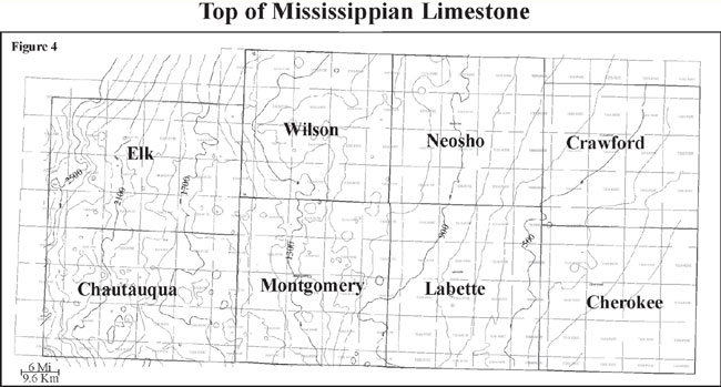
In southeastern Kansas, Cherokee Group clastic rocks (Desmoinesian Stage, Middle Pennsylvanian Series) unconformably overly Mississippian limestones (Meremecian stage; Merriam, 1963). The top of the Mississippian is characterized by a chert residue that is referred to by drillers as "chat" (Watney et al., 2001). Depth to the Mississippian basement in the Cherokee basin ranges from 0 feet at outcrops in the extreme southeastern corner of Kansas to more than 2500 feet (762 m) in Elk and Chautauqua Counties as the Mississippian and Cherokee Group rocks gradually dip to the west and southwest.