| Kansas Geological Survey Open-File Report |
Index of Images || Small Web Image || Large Web Image || Acrobat PDF (16.3 Megs)
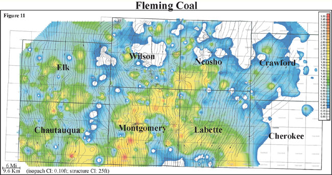
Isopach mapping of the Fleming coal reveals a coal that is laterally discontinuous but has a consistency in thickness over an average of 4 miles (6.4 km). Thickness of the Fleming coal ranges from 0 to 2.6 feet with an average of 1 foot and a distribution skewed to the minimum (0 to 0.8 m, average of 0.3 m). The Fleming coal exhibits a dendritic geometry that is oriented parallel to depositional dip. In contrast with some of the other Cherokee Group coal deposits in the study area, structure does not appear to have as much control on coal thickness. The Fleming coal is consistently thicker in the southern half of the study area. Thin or zero coal trends of the Fleming coal appear to be the result of non-deposition.