http://www.kgs.ku.edu/PRS/AAPG2005/karst/p1-02.html
Last Modified December 2005
|
Using New 3-D Seismic Attributes to Identify Subtle Fracture Trends |
Kansas Geological Survey |
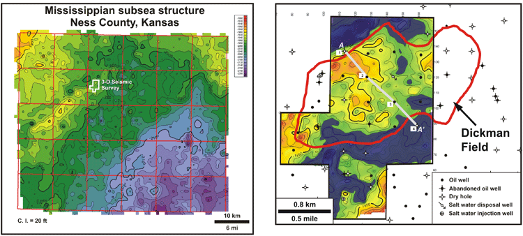
Location map for the Dickman Field 3-D seismic survey (black outline) showing detailed Mississippian subsea structure derived from 3-D seismic interpretations. C.I. = 10 ft. The blue shaded overlay indicates areas where the Mississippian is entirely beneath the oil-water contact.
Dickman Field, in Ness County, Kansas, is a typical Mid-Continent Mississippian reservoir. The reservoir is composed of Meramecian shallow-shelf carbonates, subjacent to a regional pre-Pennsylvanian unconformity and karst surface. Since its discovery in 1962, Dickman Field has produced nearly 1.7 million barrels of oil, with a high water cut (greater than 94%).
New seismic attributes were applied to a 3-D seismic survey over Dickman Field in an attempt to more effectively locate fractures influencing fluid flow in this reservoir.
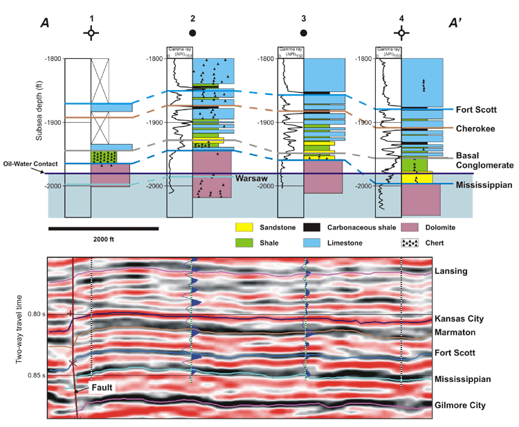
Cross section A-A’ across Dickman Field, showing lithologic (top) and seismic (bottom) data. Synthetic seismograms calculated from sonic logs in wells 2 and 3 are displayed in blue on the seismic section. Note that Dickman Field is bounded to the northwest by a fault.
http://www.kgs.ku.edu/PRS/AAPG2005/karst/p1-02.html
Last Modified December 2005