Basement Geology and Structure
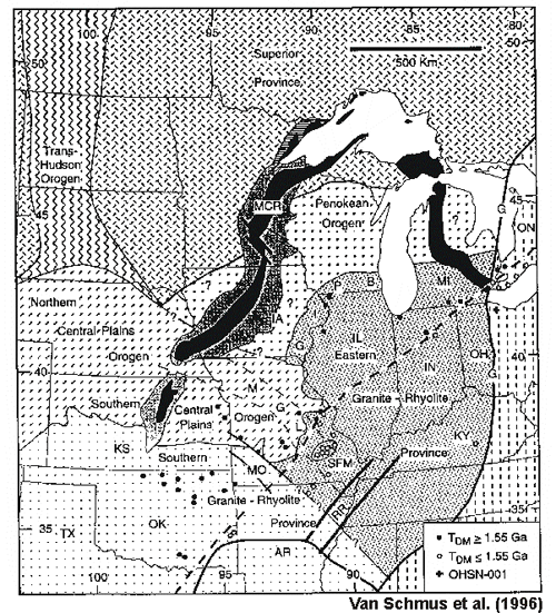
Major Precambrian geologic features of the Midcontinent region |
|
 |
Hypothesis tested in this presentation – Episodic basement deformation serves as a template for segmentation of the shelf and strongly influences the location of carbonate petroleum reservoirs under examination.
Focused deformation is associated with basement weaknesses in the Midcontinent -- episodic, affecting deposition and post-depositional processes often leading to stacked pay zones and indications of deep seated, early structure in younger rocks.
The basement of the upper Midcontinent has been studied extensively using well cuttings, cores, and limited outcrops augmented with the interpretation of potential fields geophysics and, locally, seismic data. |
Generalized map of Precambrian terranes in Kansas, showing ages and lithologies, with major Kansas historical structures identified
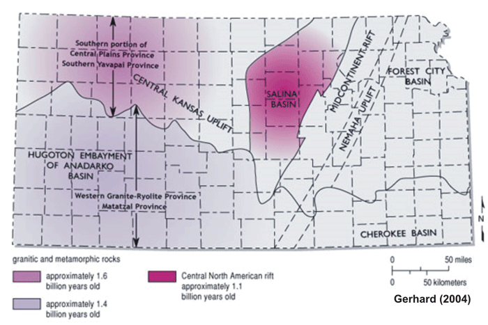
Modified from Newell et al., 1987. Southern portion of Central Plains Province (Van Schmus et al., 1987); Southern Yavapai Province (CD-ROM Working Group, 2002); Western Granite-Rhyolite Province (Van Schmus et al., 1987); Mazatzal Province (CD-ROM Working Group, 2002).
Configuration of the top of Precambrian emphasizing major fault systems

Depending on the interpreter, the Precambrian basement configuration has been depicted with considerable faulting or very limited faults. It is a matter of preference and style of mapping, reflecting limited basement penetrations and near vertical faulting. Similarly, shallower Phanerozoic horizons can be mapped as continuous surfaces or more faulted and discontinuous. The current paradigm has emphasized continuous mapping, but with the advent of 3D seismic, this paradigm of continuity is evolving toward less continuity and instead more segmentation/faulting.
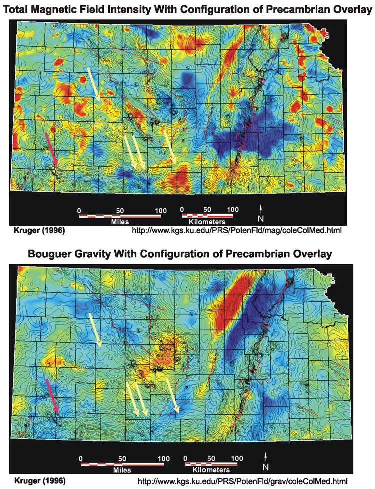
Overlay of the basement configuration on gravity and magnetics maps reveal correlations with compositional and structural variations of the basement (Kruger, 1996). Moreover, the Precambrian terranes mapped using the gravity and magnetic maps provide the means to systematize the basement framework and collectively associate them with Phanerozoic structures.
http://www.kgs.ku.edu/PRS/AAPG2005/controls/p2-01.html
Last Modified January 2006