


|
|||||||||||||
|
|||||||||||||
|
|||||||||||||
|
|||||||||||||
|
|||||||||||||
|
|||||||||||||
|
|||||||||||||
|
|||||||||||||
In this example, we are using Township 23 South, Range 31 West, Section 12 in Finney
County, Kansas
Start on the MIDCARB
Map Interface page.
Zoom in to Kansas.
In the Map Layers Frame, set your Active Layer to KS Cumulative Oil Production
In the Petroleum Folder, turn on KS Cumulative Oil Production
On the map below, Finney County is outlined and the section of interest is the dark
green spot.
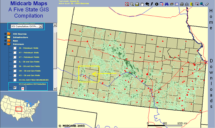
Zoom in closer to the section of interest.
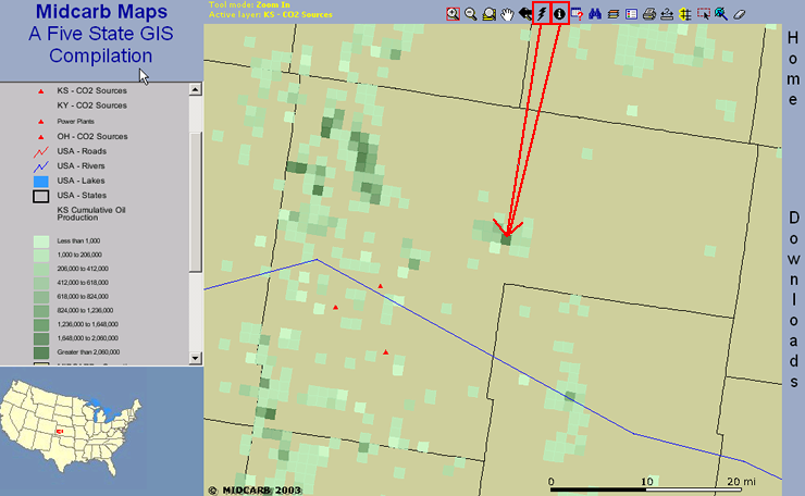
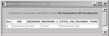
First, choose the Identify Tool ![]() and click on the dark green square, which is the township-range-section location
that we are interested in. If your browser allows pop-up windows, you will see the
window below. Take note of the TOTAL_OIL figure because you will need it later.
and click on the dark green square, which is the township-range-section location
that we are interested in. If your browser allows pop-up windows, you will see the
window below. Take note of the TOTAL_OIL figure because you will need it later.
Then, choose the hyperlink tool ![]() and
click the same dark green square. The window below will pop-up.
and
click the same dark green square. The window below will pop-up.
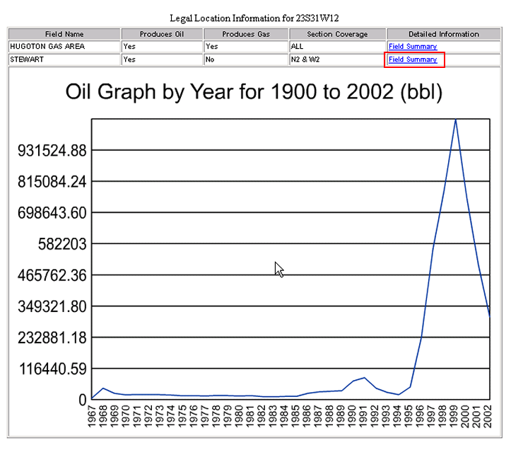
We happen to know that this section is in Steward Field so we can click on the Field Summary for Stewart Field.
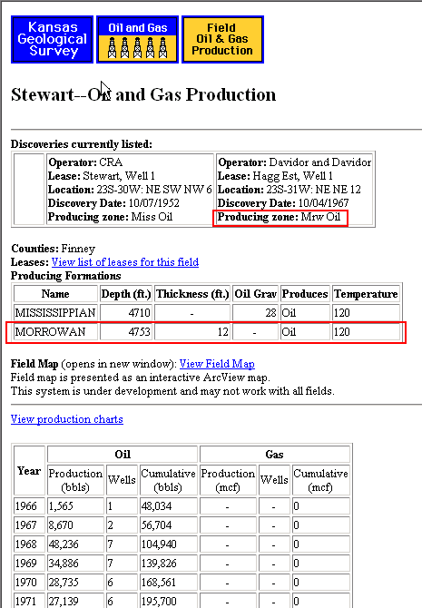
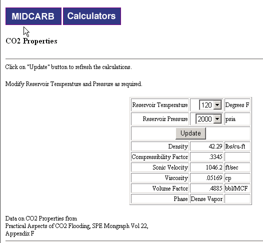
Notice in the Producing Formations table, that for MORROWAN the temperature is 120, the depth is 4753 and the thickness is 12. Now go to the MIDCARB Calculators Page and open the CO2 Properties Calculator. Enter 120 for Reservoir Temperature. The Reservoir Pressure is the depth (4753) times .43, or about 2000.
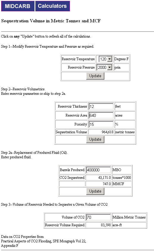
Now go back to the calculators page and select the Sequestration Volume in Metric Tonnes and MCF Calculator. Again, enter the temperature and pressure and after clicking Update, the second step will appear. Enter the thickness of 12, which we learned earlier. The reservoir area is one section, which is 640 acres. The porosity in this case is 15%, which you have to know. Enter 400,000 MBO for the Cumulative Thousands of Barrels of Oil Produced for the section and you will see that you could sequester 43 million tonnes of CO2 in that section. Alternatively, you could use step 3 to determine the acre-feet necessary to sequester some amount of CO2. In this case, we entered 70 million metric tonnes of CO2.
Home ||
Map
Interface ||
Calculators ||
Reports ||
Contacts

 Go to Top of Page