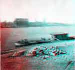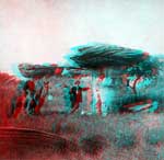


The original photos can be viewed at the Kansas State Historical Society web site as part of their photo collection.
The tour of photos starts in St. Louis, Missouri, with photos of a small river ferry and the train station.


These photos have been processed to show three-dimensions using two colors (anaglyph) and should be viewed with "3-D" glasses with red for left eye and cyan for right eye. The Survey does not sell them, but here is one source, and others can be found on Google.

The tour includes photos of the Mushroom Rocks in western Kansas.

Begin your tour here...
If you are using Google Earth, this file will place the photo locations on your map. You can also view the images on maps.google.com (Leavenworth and East, Lawrence and Tonganoxie) and Topeka and West). Not all images have been installed at this time.
Kansas Geological Survey
Updated April 6, 2005.
Comments to webadmin@kgs.ku.edu
The URL for this page is http://www.kgs.ku.edu/Images/Gardner/index.html