


|
|
|
|
On Thursday, April 12, 2001, a plane carrying a National Aeronautics and Space Administration (NASA) methane gas-detecting instrument began a series of flights over Hutchinson and vicinity. While the flights are experimental, they may help identify where natural gas is still emerging from the ground.
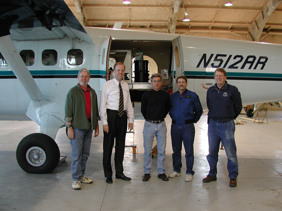
Earlier in the week, project participants prepared for the mission. Pictured below, from left to right, are Lee Allison (Kansas Geological Survey participant), Jerry Moran (U.S. Congressman), Dave Rider and Ron Steinkraus (NASA's Jet Propulsion Laboratory participants), and Les Showell (National Severe Storms Laboratory participant).
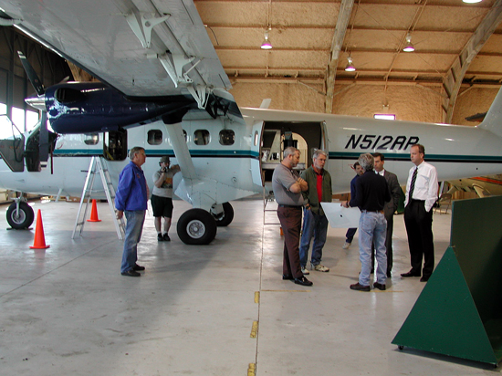
In the photo below, Dave Rider of the Jet Propulsion Laboratory (JPL) briefs Russ Johnson, Hutchinson Municipal Airport Manager, center, along with Rep. Moran, right, and others.
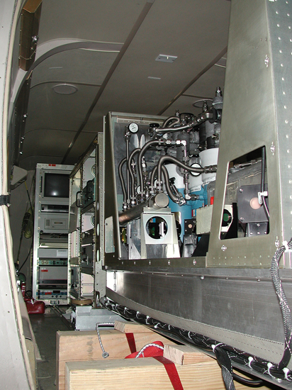
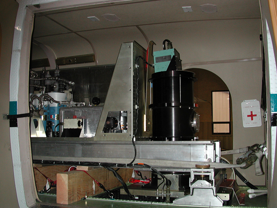
The airplane, a Twin Otter, carries an Airborne Emission Spectrometer (AES) that looks for the infrared signature of methane, the main constituent of natural gas. The plane will make numerous sweeps over Hutchinson and surrounding area, flying at altitudes ranging from 1,000 to 6,000 feet. Thursday's flight targeted vent wells and areas that were known to be venting natural gas, and helped to calibrate the AES. Weather permitting, the flights will continue for approximately ten days. The data will later be analyzed at the Jet Propulsion Laboratory (JPL) to see how well the machine was able to detect low levels of natural gas. The quality of the data may depend on weather conditions, with sunny and calm conditions yielding the best results.
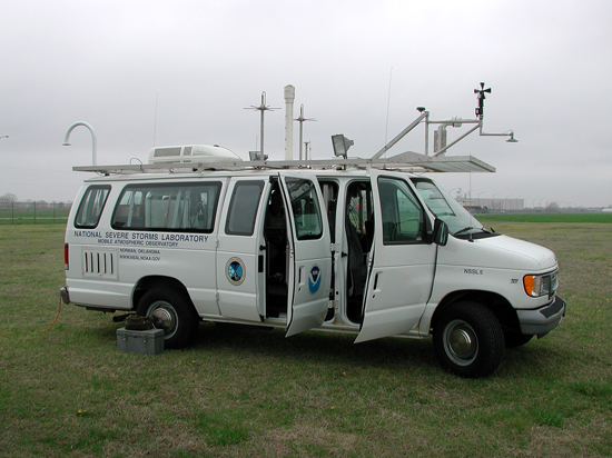
The National Severe Storms Laboratory (NSSL) is suppporting the experimental mission. Daily, NSSL launches a weather balloon carrying an instrument package that will assist the NASA study. The balloon carries a radiosonde that transmits wind speed, air temperature, air pressure and humidity readings to a computer in the NSSL van. The data will be incorporated to accurately calibrate the AES.
Hutchinson and Wichita news media are following the mission closely.

The flight paths for the mission are illustrated below, followed by photographs from the Twin Otter.
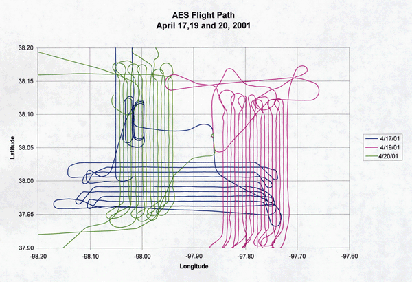
Photo 1 (below): north of Hutchinson, looking south.
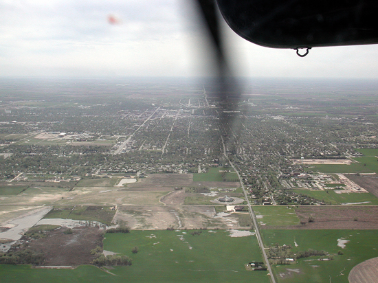
Photo 2 (below): northwest of fairgrounds, looking southeast.
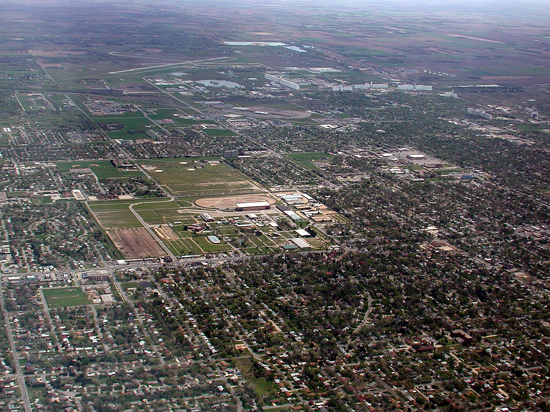
Photo 3 (below): Yaggy field, looking south.
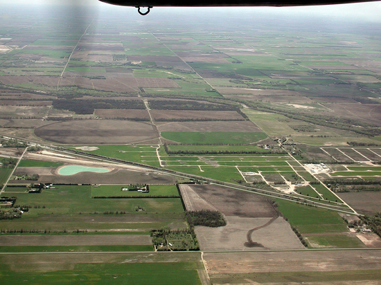
Photo 4 (below): south of Hutchinson, looking northwest.
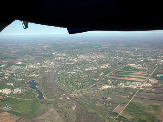
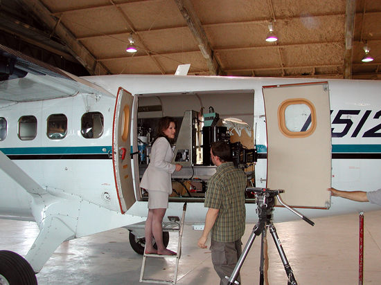
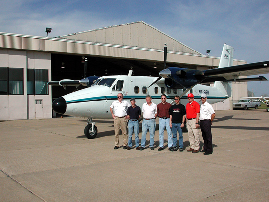
Photo 5 (below): Twin Otter and AES Team in front of the Mead
hangar, Hutchinson, Kansas.
From left to right--Bill Clark, Dave Rider, Dave Petterson, Kevin Bowman, Brendan
Fisher, Les Showell and David Dilley.

|
On March 31, 2001, a flight of opportunity was undertaken by the NASA ER-2 to overfly Hutchinson. Data were collected by a University of Wisconsin - Madison infrared spectrometer, which has the potential to detect anomalous levels of methane (the Scanning High-resolution Interferometer Sounder, S-HIS). A summary of the mission was provided by the University of Wisconsin, Space Science and Engineering Center. Three options are available for viewing and/or downloading:
As a html document for wiewing with a web browser:
As a Microsoft Powerpoint presentation, which may be downloaded (or opened and viewed if the user has the appropriate software and browser settings):
The summary is also available as an Adobe Acrobat PDF file, which may be viewed with the free Acrobat Reader.