


|
|
|
|
|
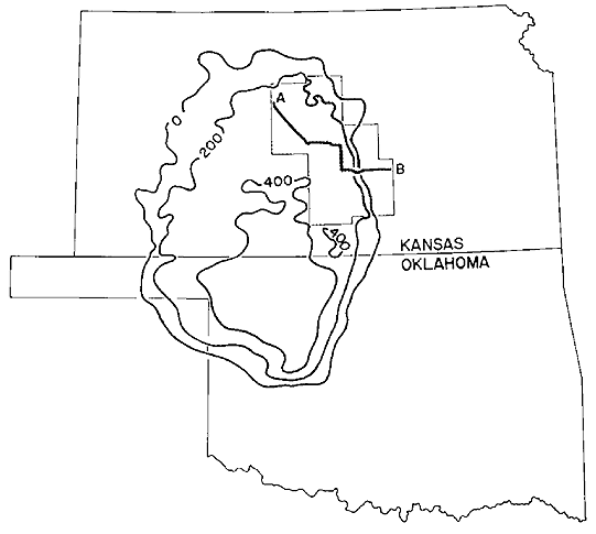
| Extent and thickness (in feet) of the Hutchinson Salt Member (after Walters, 1978) |
|---|
 |
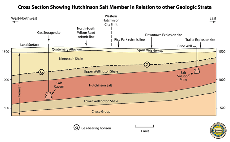
The gas-bearing interval in the Hutchinson area ranges from 270 feet deep on the east side of the city to 400 feet below the surface several miles northwest of the city. The interval gently dips to the west-northwest at approximately 20 feet per mile. The samples to date indicate that the gas-bearing interval contains thin interbedded layers of gray to dark gray and red-brown shale with several distinctive, but relatively thin beds of gypsum and dolomite. The gas appears to be associated with the occurrence of the dolomite layers. Dolomite layers may contain porosity in the form of small pores and fractures needed to store and transmit the natural gas. The natural gas is moved in pore spaces that are connected; fractures can account for fluid movement including the gas.
Natural gas has only reached the surface through unplugged, abandoned boreholes connected between the gas zone and the surface in and near Hutchinson or through vent wells drilled purposely under controlled conditions to intercept the gas. The strata immediately overlying the gas-bearing interval contain thicker gypsum beds and appear to act as seals, prohibiting the upward migration of natural gas. This sealing interval may be much of the reason for the thin gas accumulation.
UPDATE on 4/18/01: Last week, natural gas was reported to be reaching the land surface through the soil/rock column, and not through a well bore, in Sec. 31, T22S-R6W, south of the Yaggy storage facility. This report is under investigation.
Spatially, the gas-bearing vent wells and unplugged leaking holes are located approximately along a west-northwest trend bisecting the city. This locus of accumulation corresponds to other geological features including the orientation of the Arkansas River and its ancestral drainage. A 4-mile long seismic line acquired by the Kansas Geological Survey along Wilson Road further suggested gas accumulation along isolated areas that cross this line of section. Additionally, mapping information obtained from wireline logs from the vent wells is providing a refined view of the variations in structure and stratigraphy that suggest some correspondence to the venting gas wells. The efforts continue to tie down geological and geophysical signatures of this gasbearing interval.

|
|
Prev Topic--Background || Next Topic--Structure Maps