Last modified:
03/01/2000 - jas
Supplementary Plots of Water-Level Decline Rates
Table 2a: Annual rate of decline (ft/yr) by decade for
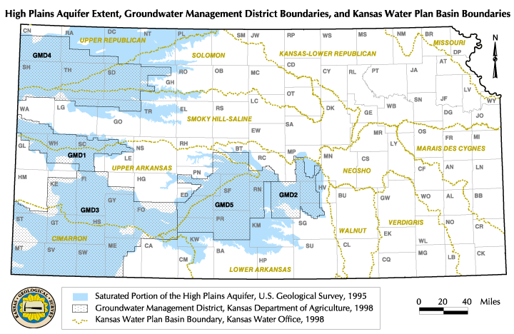
the Ogallala Aquifer and Groundwater Management Districts (see introductory
map for location of regions).
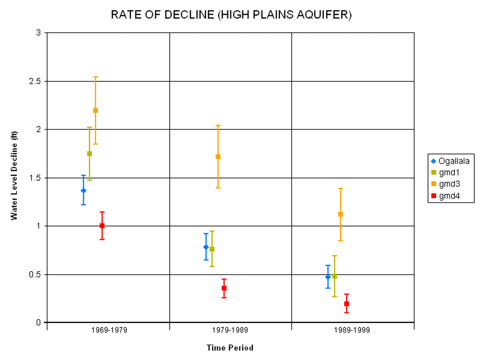
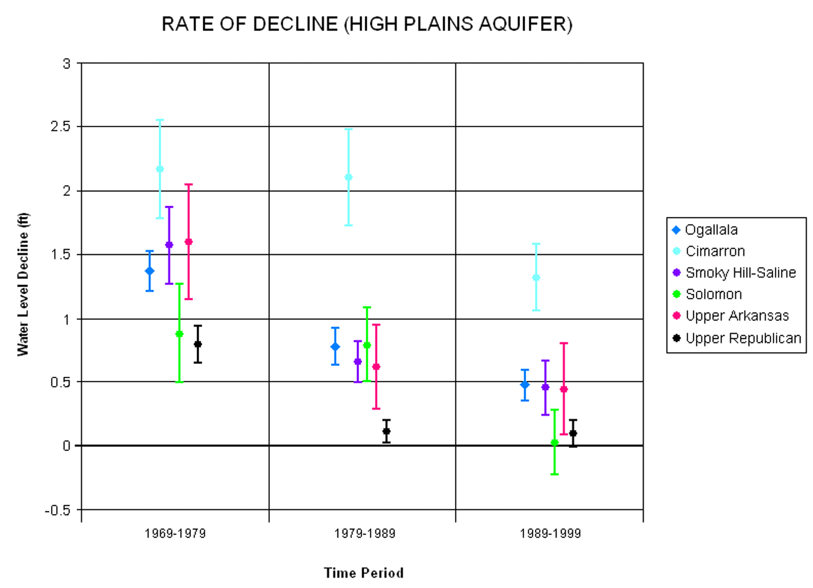
Table 2b: Annual rate of decline (ft/yr) by decade
for Ogallala Aquifer and River Basin areas (see introductory
map for location of regions).
If you wish to submit comments,
please include the name of the web page on which you are commenting
in your email message.