Kansas Geological Survey, Open-file Report 1999-33
by Richard D. Miller,
Jianghai Xia,
Choon B. Park,
Joe M. Anderson,
and Mitchell Fiedler
Kansas Geological Survey
KGS Open-file Report 1999-33
November 1999
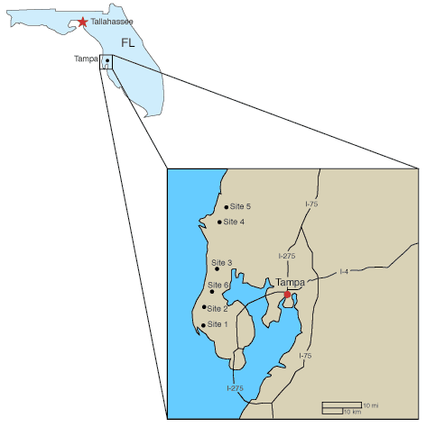
The shear wave velocity field, calculated using the Multi-channel Analysis of Surface Waves (MASW) method (Park et al., 1999; Xia et al., 1999), helped identify variability in the lateral continuity of near-surface layers in and around surface structures with damage that appears to be related to non-uniform earth settling in the Tampa, Florida area (Figure 1). Depths of investigation extended from a few feet below ground surface (BGS) to as much as 100 ft BGS in some cases. Anomalies interpreted in "bedrock" near all six structures studied could be related to subsidence effects observed at the ground surface. Previous drilling and resistivity investigations at these six sites has not conclusively identified a geologic/structural situation that could be definitively correlated to sinkhole activity. When comparing this study to previous investigations using this surface wave imaging technology at sites around the country (Miller and Xia, 1999a; Miller and Xia, 1999b), it is interesting to note the inability to detect or discern a unique velocity pattern consistent with all subsidence features. In most cases, an anomalously low velocity within bedrock was detected and proposed to be indicative of dissolution and the subsidence implied by change in the shallow low velocity zone. Extrapolations between the "bedrock" features and the affected area on or near the ground surface required speculation as to the connectivity of the features interpreted to be subsidence related within the "unconsolidated" sediments. In each of the six areas studied, subsurface variations in shear wave velocity patterns above the interpreted/inferred bedrock surface were interpreted that could be associated with the subsidence responsible for structural damage.
Figure 1. Map showing relative placement of sites near Tampa, Florida.
Calculating the shear wave velocity field from surface wave arrivals can generally be accomplished with a high degree of accuracy regardless of cultural noise or obstacles. Data for this study were acquired in and around occupied personal residences requiring adaptations be made for cement and asphalt as well as for limitations and restrictions in generating acoustic energy inside houses, around swimming pools, and through gardens. Care was taken to insure no data carried artifacts related to surface features and all data were acquired with special attention placed on the spread location relative to surface materials and structures. Comparisons of data characteristics recorded from geophones with steel baseplates to those with spikes revealed no significant difference in wavetrain properties or calculated dispersion curves. Of particular concern during data acquisition was geophone placement inside houses where floor coverings ranged from carpet to ceramic tile to cement. Unlike recording concerns prominent when using other types of acoustic waves, surface waves seem to have only limited dependence on changes in receiver coupling. Non-source noise recorded on surface wave data reduces the quality of the dispersion curve but does not usually prevent an accurate and robust inversion.
MASW provides shear wave velocity profiles accurately (15%) representing average shear wave velocities for a particular subsurface volume (Xia et al., in review). Velocities measured during this study ranged from just over 100 ft/sec to around 2100 ft/sec. Localized changes of over 1300 ft/sec (400%) across distances less than 10 ft were common around areas with observed structural damage. Velocity inversions are prominent within the upper 20 ft and likely relate to stiffer clays or partially cemented sediments in close proximity to sand or gravel zones. The sensitivity of shear wave velocities to changes in sediment makeup correlates to differing degrees with other imaging techniques and/or observed differences in material composition. There does not seem to be a unique characteristic or property of the shear wave velocity field diagnostic of subsidence activity at all the Tampa sites studied. Interpreting these data requires incorporation of drilling, borehole measurements, and other geophysical soundings. Data acquired for this study, in general, have relative gradational vertical and horizontal variations in shear wave velocity when compared to data from other sites with noted subsidence activities. This apparent lack of sensitivity could be unique to the structural properties of the sediments in this area (subsidence results in only subtle changes in stiffness/rigidity), resolution limitations of the method, or the subsidence mechanics in the Tampa, Florida area. Sediments described in drill cuttings and correlated to blow counts seem to be generally consistent with velocity profiles and associated gradients.
Interpreting changes in lithology with this technique has routinely involved correlating high velocity gradients and measured velocities to ground truth. Velocity fields at most of the six Tampa sites possess distinguishable velocity inversions at or around 10 ft to 20 ft BGS with large velocity gradients immediately above and below. High velocity closures, likely indicative of extreme lateral variability in sediment cementation, appear sporadically within the unconsolidated portion of the section. These localized changes in cementation will strongly influence the linearity and preferred subsidence migration path from the bedrock to ground surface. Interpreting the bedrock surface based solely on the high velocity gradient could not be done with confidence using only the shear wave data. The gradational nature of the shear wave velocity field makes interpreting the surface of bedrock a bit speculative across most of the lines. However, incorporating drill information with interpretations of laterally continuous high velocity gradients makes it possible to trace the top of bedrock beneath most sites. The roughness of the bedrock surface strongly influences the gradational nature of the velocity field in proximity to bedrock. This roughness is suggestive of dissolution or erosional activity.
Large velocity gradients in the shear wave velocity field near the expected depth of bedrock (stiffer layers seeming more laterally continuous) were used as diagnostic of the bedrock surface, while localized lateral decreases in the shear wave velocity below the bedrock surface were considered characteristic of fracture zones or dissolution features. The depth-to-bedrock interpreted using shear wave velocity data and drilling logs possesses significantly higher resolution than drilling alone. Advantages of mapping variations in the shallow stratigraphy with the shear wave velocity field calculated from surface waves using MASW include a disregard for velocity inversions, ease of generating and propagating surface wave energy in comparison to body wave energy, being oblivious to cultural noise (mechanical or electrical), and sensitivity to lateral changes in velocity.
Kansas Geological Survey, Geophysics
Comments to webadmin@kgs.ku.edu
The URL for this page is http://www.kgs.ku.edu/Geophysics/OFR/1999/33/index.html