Background and Development of the Interactive County Geology & Water (ICGW) website
The advent of new computer web-based technologies and Geographical Information Systems (GIS) software applications provided the opportunity to create a dynamic Construction Material Inventory (CMI) digital platform. In 2006, with funding provided by KDOT, the Kansas Geological Survey assigned personnel and resources to develop a CMI website pilot project starting in Pottawatomie County. At the KGS headquarters in Lawrence, Kansas, field geologists with student assistants worked with website development experts to digitize and place point data online. GIS specialists, cartographic experts, and Data Access/Support Center personnel (DASC) labored to place a variety of interactive mapping tools and geographical-based overlays alongside the current digital geology map for Pottawatomie County. In the fall of 2007, the new CMI site was published and added to the KGS website homepage.
Following the successful rollout of the CMI website, it was realized among KGS researchers, scientists, and administrators that a similar GIS-interactive map website-based application would be useful in presenting and updating past KGS publications, and in presenting newly acquired geological and water resource information.
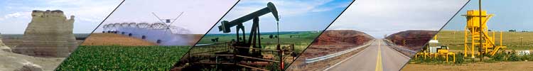
Over the years, the Kansas Geological Survey has published at least 38 bulletins covering 47 Kansas counties and detailing geological research and fieldwork regarding the county geology, hydrology, and water resources. Like the KDOT Construction Material Inventories, the KGS publications were static information tools, difficult to update and to make readily accessible to interested parties.

During the late summer and early Fall of 2007, as the CMI website was being launched, KGS personnel were able to quickly put together a prototype website based on their experience in putting together the material construction inventory. Saline County was selected as the pilot project because no KGS, USGS, or KDOT agency had ever published a bulletin in this area, and because a new draft copy of an updated geology map had just been completed by Jim McCauley, KGS field geologist. This newer geology map was quickly converted into a digital database and installed as the basic interactive map feature for the website. A literature survey is finished and the accompanying bibliography is available. Preliminary downloading of specific site information has been completed. Additional fieldwork information will be added to the site as time progresses.
Some key ICGW website capabilities:
- Links to related websites and digital libraries (USGS, KWO, KDHE, EPA, USACE, etc.)
- The ability to navigate swiftly to precise locations and return to a full-county view.
- Dozens of geographically fixed locations than can be "clicked" on to access additional data.
- The capability to view a particular site that can be overlain with digital transparencies for geology, topography, aerial photography, roads, rivers, streams, city and county boundaries, etc.
- The capacity to overlay a particular site with the WWC5 and Oil and Gas databases.
- The ability to print out a map of the specific area you want with the GIS features of your choice.
The basic website architecture and GIS framework is complete. A principle new advantage is that the web-based computer environment provides the opportunity to have hydrological and geological information maintained and updated on a continuing basis as new data becomes available. The long range goal is now to build upon this pilot study to create updated interactive computer-based platforms for all Kansas counties, with the priority going to where the need for information is determined to be most critical.
