Generation of Color Image Cross Sections Using PfEFFER

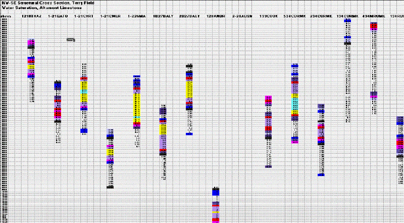
Altamont Limestone, crossection of water saturation, subsea
datum
Section height: approx. 100 feet (30.5 m);
3 miles (4.8 km) long (Terry Field)
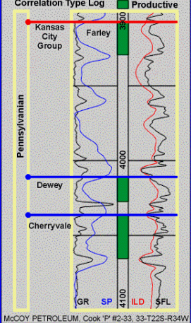
Terry Field, Cherryvale Fm. (I zone)
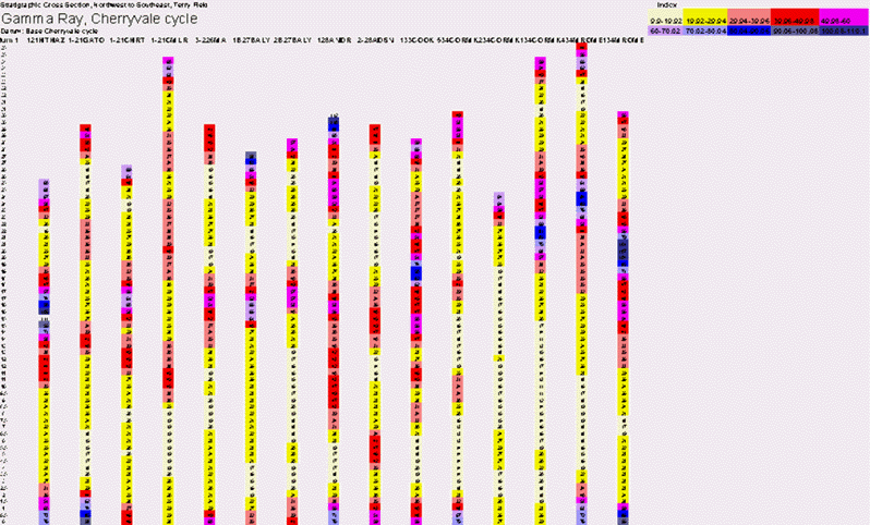
Cherryvale Fm. Cross Section, Gamma Ray, Base Datum
Cherryvale Fm. Cross Section, Porosity, Strat. Section, Base Datum

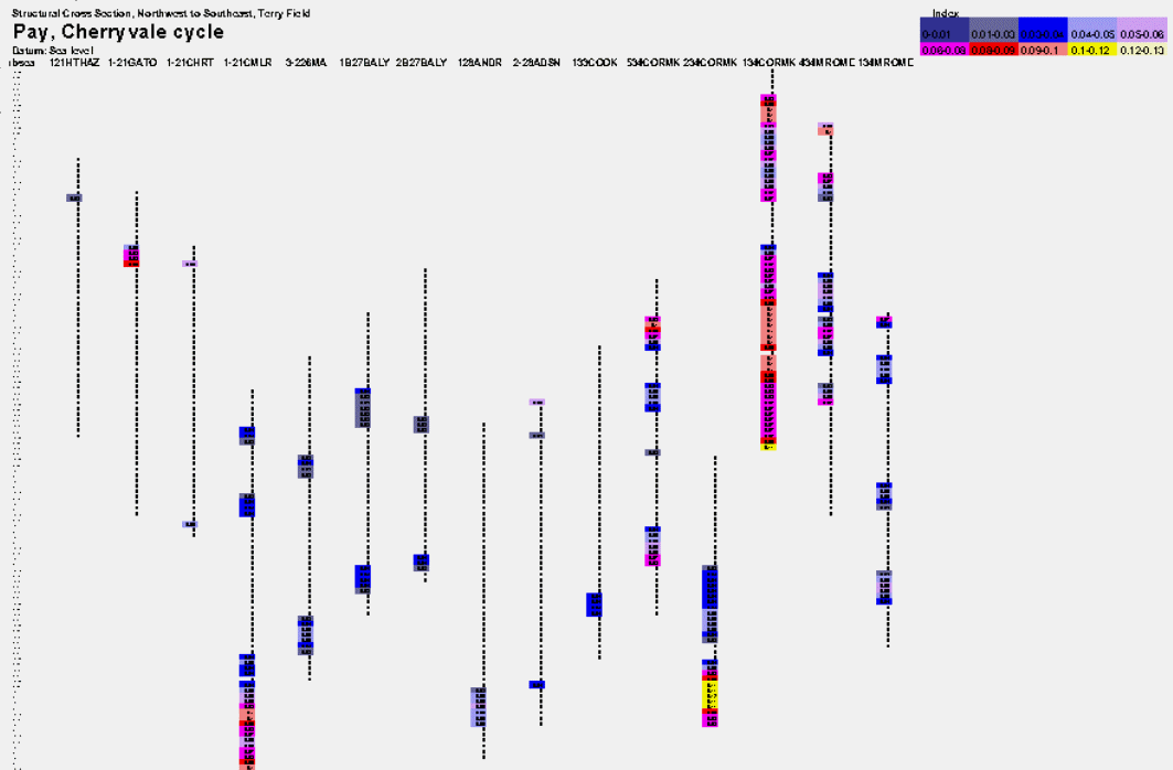
Cherryvale Fm. Cross Section, Pay, Structure Datum
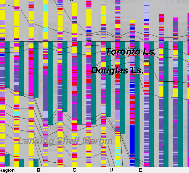
NW-SE Stratigraphic Cross Section Gamma Ray Terry Field
PfEFFER sponsor: McCoy Petroleum
PfEFFER /Excel spreadsheet
Datum: Heebner Sh.
Length: 3 miles (4.8 km)
Interval: from Heebner
into Mississippian
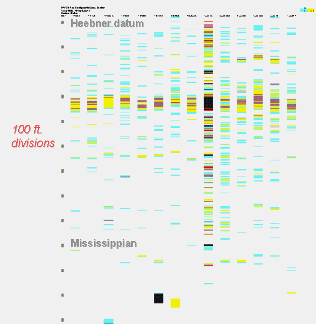
NW-SE Stratigraphic Spreadsheet Cross Section of Pay
Terry Field McCoy Petroleum
Pay cutoffs using PfEFFER:
Phi=10%
Sw=50%
Vsh=60%
BVW=0.05
Datum: Heebner Sh.
Length: 3 miles (4.8 km)
Interval: from Heebner
into Mississippian
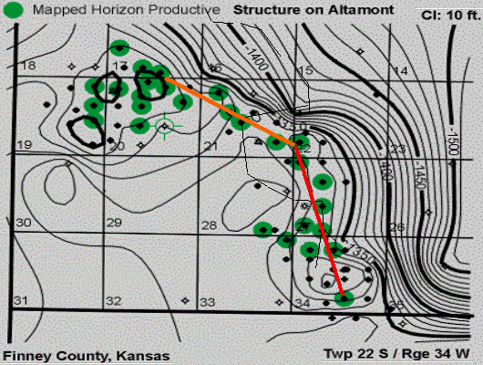
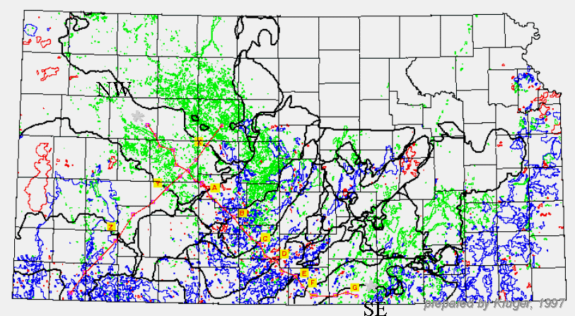
Regional NW-SE Cross Section Index -- Ness County to Sumner County, Kansas - oil fields (green), oil and gas fields (blue), gas fields (red); black lines delimit possible Pennsylvanian structural blocks linked to basement reactivation
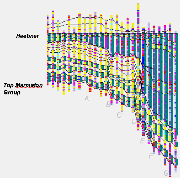
NW-SE Gamma Ray Cross Section
Yellow= Limestone
Blue/Purple=Shale/Sandstone
Heebner Shale Datum
Length: 200 miles (320 km)
Maximum interval thickness shown: 2200 feet
Ness to Sumner County, Kansas (see index map)
Oread Limestone, NW-SE Gamma Ray Cross Section
Gove County to Southern Pratt Counties --
generated using PfEFFER, image extracted from regional cross section
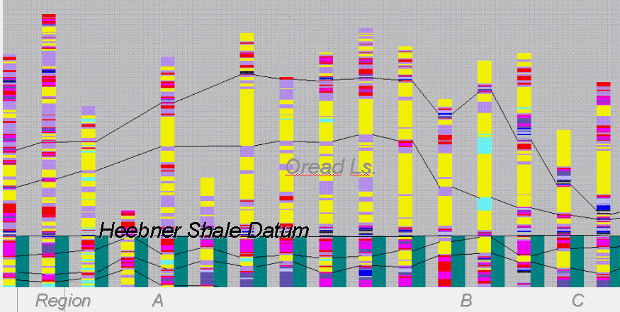
Maximum Thickness of Oread =125 ft (38 m)
Length of section = 128 miles (206 km)