![]()
Return to Fluctuations in Water Level...
Figure 7
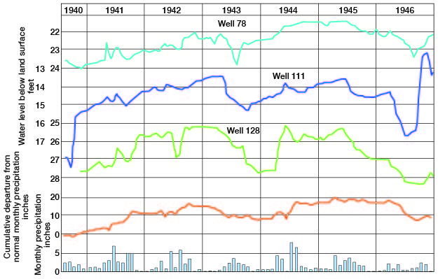
Fig. 7--Hydrographs showing fluctions of the water levels in three wells in Pawnee Valley in Pawnee County, cumulative departure from normal monthly precipitation at Larned, and monthly precipitation at Larned.
Kansas Geological Survey, Pawnee and Edwards Geology and Groundwater
Comments to webadmin@kgs.ku.edu
Web version June 2004. Original publication date March 1949.
URL=http://www.kgs.ku.edu/General/Geology/Pawnee/fig7.html