![]()
Prev Page--Contents || Next Page--Geography
Introduction
Location and Size of the Area
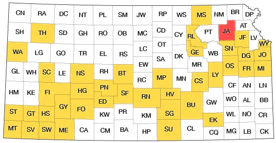
Jackson County is in the northeastern part of Kansas, in the second tier of counties south of Nebraska and in the second and third rows of counties west of Missouri. The county has an area of about 421,120 acres, or 658 square miles. Its location with respect to other counties is shown in Figure 1.
Figure 1--Index map of Kansas showing area described in this report and areas covered by other online geologic reports, as of Aug. 2007. For additional information, please visit the KGS Geologic Maps of Kansas Page.
Purpose and Scope of the Investigation
An investigation of the geology and ground-water resources of Jackson County was begun in the fall of 1949 by the United States Geological Survey and the State Geological Survey of Kansas, with the co-operation of the Division of Sanitation of the Kansas State Board of Health and the Division of Water Resources of the Kansas State Board of Agriculture.
Ground water is one of the most important natural resources of Jackson County. Nearly the entire population of Jackson County depends upon wells for water supply. The increased availability of electricity and modern sanitary facilities in rural areas and the demand for larger quantities of water in municipalities already supplied with water have materially increased the withdrawal of ground water. An understanding of the occurrence of ground water in Jackson County is necessary if this resource is to be developed to the extent needed to meet present and future demands.
The investigation was made under the general direction of A. N. Sayre, chief of the Ground Water Branch of the United States Geological Survey; and under the immediate supervision of V. C. Fishel, district engineer of the Ground Water Branch in charge of the co-operative ground-water studies in Kansas.
Previous Geologic and Hydrologic Work
Although a detailed study of the geology and ground-water resources of Jackson County has not been previously undertaken, this area is referred to briefly in several earlier reports. Haworth (1913), in a special report on well waters in Kansas, discussed the complexities of the glacial drift of northeastern Kansas and remarked upon the reliability of valley fill as an aquifer in that area. Moore and others (1940) summarized the occurrence of ground water in northeastern Kansas. The report of a reconnaissance investigation by Frye (1941) on the ground-water resources of Atchison County described the aquifers of the area adjacent to Jackson County on the east. Schoewe (1946) summarized the coal resources of Jackson County and discussed the Pennsylvanian stratigraphy of the eastern part of the county. The geology of the county in relation to oil and gas was discussed by Jewett and Abernathy (1945) and by Jewett (1949).
Methods of Investigation
Field work was begun in Jackson County in the fall of 1949 and was continued during the summer of 1950. During the investigation 255 wells were measured with a steel tape to determine the depth of the well and the depth to the water level.
Data were obtained from well owners and well drillers concerning the yield of wells and the water-bearing materials. A total of 47 test holes were drilled in the county with a portable hydraulic-rotary drilling machine owned by the State Geological Survey and operated by W. T. Connor, Lawrence Gnagy, and Max Yazza. The drill cuttings were studied in the field and later examined in the office with a microscope. The altitude of the land surface at each test hole was determined by W. W. Wilson and C. K. Bayne using a spirit level.
Samples of water from 24 wells in the county were collected and chemical analyses of them were made by Howard Stoltenberg, chemist in the Water and Sewage laboratory of the Kansas State Board of Health.
Field observations were recorded on aerial photographs and were later plotted on a base map modified from a map prepared by the Soil Conservation Service, United States Department of Agriculture. The illustrations were drafted by W. W. Wilson of the U. S. Geological Survey.
Well-numbering System
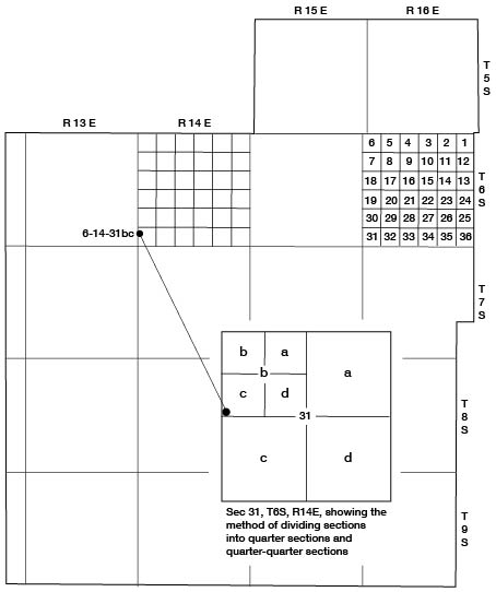
In this report, wells and test holes are numbered according to their location as given by the General Land Office system of land classification. The component parts of a well number are the township number, the range number, the section number, and the two lower-case letters which indicate, respectively, the quarter section and the quarter-quarter section in which the well is located. The lower case letters are assigned in counterclockwise order beginning with the letter a, in the northeast quarter or quarter-quarter section. For example, well 6-14-31bc (Fig. 2) is in the SW NW sec. 31, T. 6 S., R. 14 E.
Figure 2--Map of Jackson County illustrating the well-numbering system used in this report.
Acknowledgments
Appreciation is expressed to the many residents of Jackson County who supplied information and gave permission for their wells to be measured. Special thanks are due Ralph J. Bell, superintendent of Holton Water Department, and to the several water-well drillers operating in the area, for much valuable information. J. M. Jewett and Howard O'Connor spent several days in the field with me in the fall of 1950.
The manuscript of this report has been reviewed critically by several members of the Federal and State Geological Surveys; by Dwight Metzler, Director and Chief Engineer, and Willard O. Hilton, Geologist, Division of Sanitation, Kansas State Board of Health, and by R. V. Smrha, Chief Engineer, and George S. Knapp, Engineer, Division of Water Resources, Kansas State Board of Agriculture.
Prev Page--Contents || Next Page--Geography
Kansas Geological Survey, Geology
Placed on web Aug. 9, 2007; originally published June 1953.
Comments to webadmin@kgs.ku.edu
The URL for this page is http://www.kgs.ku.edu/General/Geology/Jackson/02_intro.html