Sedgwick County
|
|
Sedgwick County |
|
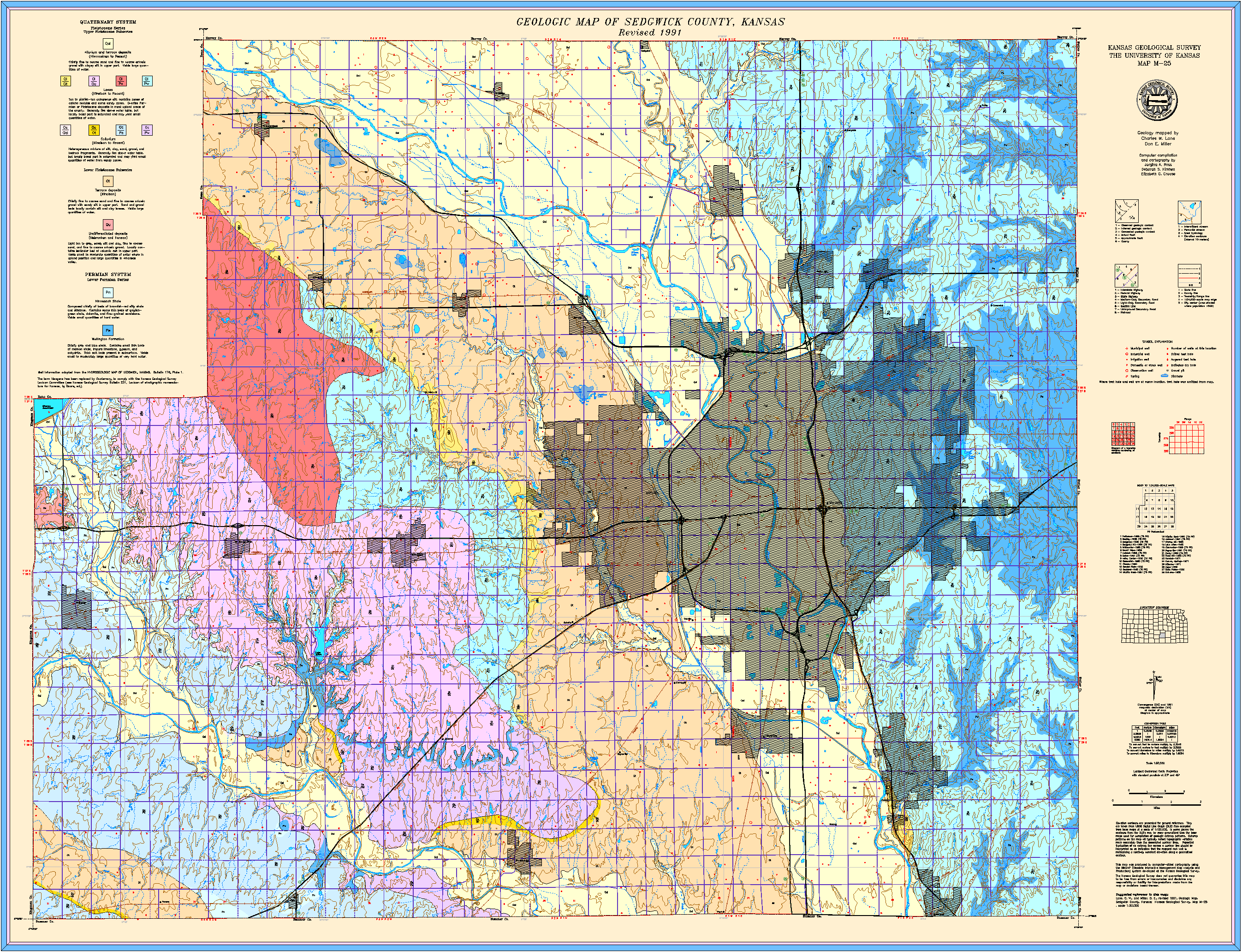
Lane, C.W., and Miller, D.E., 1991, Geologic map, Sedgwick County: Kansas Geological Survey, Map M-25, scale 1:50,000, 42 x 54 inches
Paper copies of the complete map (with stratigraphic column and legend info) can be purchased from the Kansas Geological Survey, 1930 Constant Ave., Lawrence, KS 66047 (or phone 785-864-3965) and at 4150 W. Monroe St., Wichita, KS 67209-2640 (phone 316-943-2343).
Geohydrology of Sedgwick County, Kansas, by Charles W. Lane and Don E. Miller. Originally published in 1965 as Kansas Geological Survey Bulletin 176, this online version has been created because the published version is currently out of print.