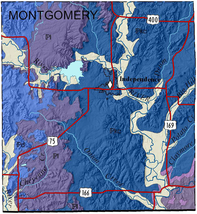
Montgomery County

|
|
Montgomery County |
|
|
|
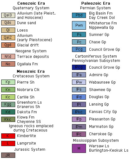
Bennison, A.P., assisted by Collins, D.R., 1996, Geologic map, Montgomery County, Kansas: Kansas Geological Survey, Map M-44, scale 1:50,000, 42 x 40 inches
Paper copies of the complete map (with stratigraphic column and legend info) are available from the Kansas Geological Survey, 1930 Constant Ave., Lawrence, KS 66047 (or phone 785-864-3965) and at 4150 W. Monroe St., Wichita, KS 67209-2640 (phone 316-943-2343). The cost is $15.00 plus handling and sales tax.
O'Connor, Howard G., 1974, Geology and Ground-water Resources of Montgomery County, Southeastern Kansas: Kansas Geological Survey, Ground-water Series 1, 12 p., 1 pl. [available online]
The Kansas Data Access and Support Center (DASC) has ArcInfo coverages available for this generalized geologic data.
Cartographic Services, Kansas Geological Survey
Updated Jan. 9, 2007
Comments to webadmin@kgs.ku.edu
URL=http://www.kgs.ku.edu/General/Geology/County/klm/montgom.html