


Kansas Geological Survey, Open-File Rept. 96-1a
Proposed Management Areas--Figure 2
Use the "Back" command on your browser to return to the page you were reading.
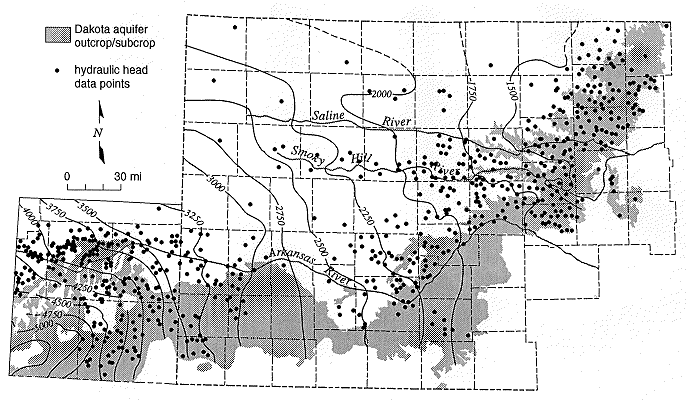
Figure 2. Elevation in feet above mean sea level of the
pre-development potentiometric surface of the Dakota aquifer in
southeastern Colorado and western Kansas.
Start of this report ||
Table of Contents
Kansas Geological Survey, Dakota Aquifer Program
Original report available from the Kansas Geological Survey.
Electronic version placed online July 1996
Scientific comments to P. Allen Macfarlane
Web comments to webadmin@kgs.ku.edu
URL=http://www.kgs.ku.edu/Dakota/vol3/ofr961a/figure2.htm