


Dakota Aquifer Program--Introduction
Extent of the Dakota Aquifer
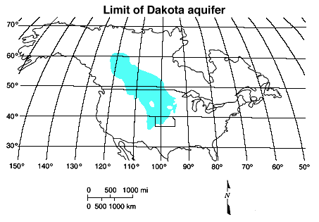
The Dakota aquifer system and its equivalents extend across much of
the central North American continent. Figure 1 is a map showing the
Dakota extent in North America. The contiguous aquifer system extends
northward from Kansas approximately to the Arctic Circle in Canada,
southward into northeastern New Mexico and the Oklahoma panhandle,
westward to the Rocky Mountain front, and eastward to western Iowa
and Minnesota.
Figure 1
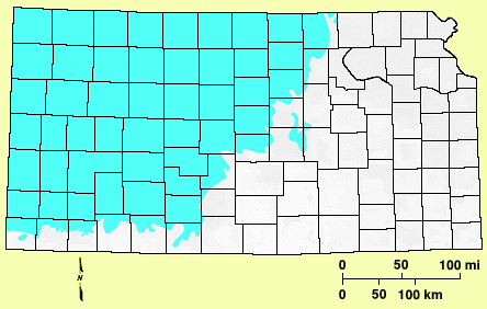
Across the Continental Divide, the Dakota aquifer is present in many
of the intermontane basins. In Kansas, the Dakota is present in most
of the western two-thirds of the state. Figure 2 shows that the
aquifer extends westward from Washington County in the north-central
part of the state and northward from Morton County in southwestern
Kansas. In all the Dakota is present in 59 of the 105 counties in
the state.
Figure 2
Dakota Home ||
Previous Page--Description of the Dakota Aquifer Program
Kansas Geological Survey, Dakota Aquifer Program
Updated April 8, 1996.
Scientific comments to P. Allen Macfarlane
Web comments to webadmin@kgs.ku.edu
The URL for this page is HTTP://www.kgs.ku.edu/Dakota/vol1/intro/extent.htm