Atokan Sandstone Stratigraphic Gas Play
by Mitchell E. Henry and Timothy C. Hester
Much like Morrow Group strata, Atoka Group strata are
oriented in a broad band that occupies most of the province, except that
part along the northeastern and southwestern edges of the province where
absent. Unlike the Morrow Group, Atokan strata include a significant
number of hydrocarbon-producing limestone reservoirs. The limestone and
sandstone reservoirs are separated geographically, with the limestone
reservoirs more prevalent in the central and northwestern part of the
province and the sandstone reservoirs more prevalent in the southeastern
part. Therefore, the Atokan Sandstone Stratigraphic Gas Play includes
all Atokan Group rocks southeast of a line that runs from about T. 13
N., R. 26 W. in Roger Mills County, Okla., to about T. 19 N., R. 14 W.
in Dewey County, Okla., except that part included in the Deep
Stratigraphic Gas Play. Depths range from about 7,000 ft in the
northeast part of the play where the Atoka Group is truncated to 13,000
ft at the southern play boundary (the upper depth limit of the Deep
Stratigraphic Gas Play).
Reservoirs
Reservoir rocks in this play are all sandstones of the Early
Pennsylvanian Atoka Group. Predominantly shale with locally developed
sands (Bingham, 1993), the entire Atoka Group ranges in thickness from
truncation along the northeastern and southern parts of the play to
about 500 ft at the southern play boundary (adjacent to the Deep
Stratigraphic Gas Play).
Bingham (1993) reported average porosity values of about 8 percent for
each of 2 Atokan reservoirs in the southern Anadarko Basin. Atoka Group
reservoirs are, for the most part, stratigraphically imbedded in shales
and are expected to be of fair quality where they exist.
Source rocks
The most likely hydrocarbon sources for this play are Atoka and Morrow
Group shales, which are either interbedded with Atoka reservoirs or in
the adjacent group of strata. Because Atoka Group rocks are thin and
directly overlie the Morrow Group, they have a similar thermal history.
That is, Atokan rocks throughout the play have reached or exceeded the
level of thermal maturation required for the onset of oil generation
(Ro
> 0.6 percent). The area of major Atokan sandstone production, however,
is much more restricted. Poor reservoir quality or perhaps an overall
lack of reservoir rock are possible explanations for the limited
distribution of production. All major accumulations in this play are
gas, therefore, the source may be Morrowan shale, which has abundant
type III organic matter (Burruss and Hatch, 1989). High thermal
maturation levels near the boundary of the Deep
Stratigraphic Gas Play may also have generated
some gas from the type II kerogen, or generated but did not expel oil.
Timing and migration
Timing of trap formation and hydrocarbon generation is favorable for the
charging of reservoirs in this play. Petroleum generation probably
began between 300 and 250 Ma in this play (Schmoker, 1989). The limited
distribution of production in this play requires only short distance
migration of hydrocarbons.
Traps and exploration status
Trap types for this play include stratigraphic (Bingham, 1993) and
combination. Seals are formed by Atokan and Desmoinesian shales. Major
reservoirs range in depth from approximately 9,700 to 13,000 ft.
Reported well penetrations for the entire Atoka Group number only about
8,400, as compared to about 26,000 for the entire Morrow Group. This
number may be low because of the difficulty in determining the top of
the Atoka Group in the subsurface. The actual number of well
penetrations is probably similar to, or greater than, that of the Morrow
Group (~26,000). Consequently, the Atoka Group is probably at least as
well explored as the Morrow Group. Of the 8,400 well penetrations in
the Atoka, about 542 are hydrocarbon producers. Six major accumulations
are assigned to this play; all are gas. The largest accumulation is at
Watonga-Chickasha Trend with an estimated ultimate recovery of 320 BCFG.
All major future discoveries are also expected to be gas.
Resource potential
Because of the relatively high level of exploration and the general lack
of major discoveries, the potential for future major discoveries in this
play is considered limited. The very localized nature of sand
development (Bingham, 1993) may be the most serious limitation for
future discoveries in this play. Historical production and well
completion data are the foundation for the assessment of this play.
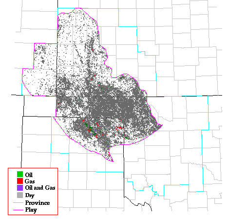
Play Map
References
Bingham, T.L., 1993, Atoka marine sandstone--Anadarko basin, Oklahoma,
in Debout, D.G., White, W.A., Hentz, T.F., and Grasmick, M.K.,
Atlas of major Midcontinent gas reservoirs: p. 40.
Burruss, R.C., and Hatch, J.R., 1989, Geochemistry of oils and
hydrocarbon source rocks, greater Anadarko basin--evidence for multiple
sources of oils and long-distance oil migration, in Johnson,
K.S., ed., Anadarko Basin Symposium, 1988: Oklahoma Geological Survey
Circular 90, p. 53-64.
Schmoker, J.W., 1989, Thermal maturity of the Anadarko basin, in
Johnson, K.S., ed., Anadarko Basin Symposium, 1988: Oklahoma Geological
Survey Circular 90, p. 25-31.
Kansas Geological Survey, Digital Petroleum Atlas
Updated July 16, 1996
Comments to webadmin@kgs.ku.edu
URL=http://www.kgs.ku.edu/DPA/frontEnd/Anadarko/Atokan/provSum.html