Basin: Anadarko
County: Grant and Stanton counties
|
| ||
|
|
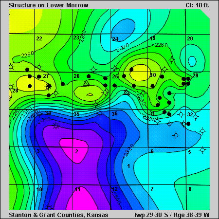
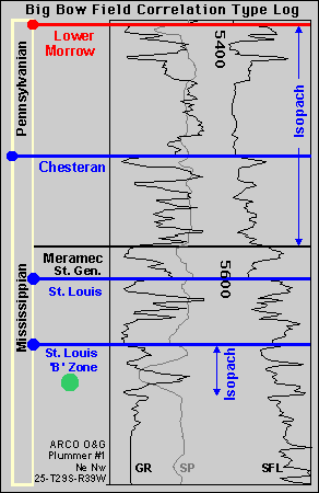
Play: St. Louis
(Lower Mississippian) Basin: Anadarko County: Grant and Stanton counties Big Bow FieldClicking on the small blue circles or on the blue isopach labels on the stratigraphic column will take you to pages showing structure or isopach maps. You can also use the buttons at right to investigate the Big Bow area. |
|