|
|
HELP: Kansas Geological Survey (KGS) - Measured Sections |
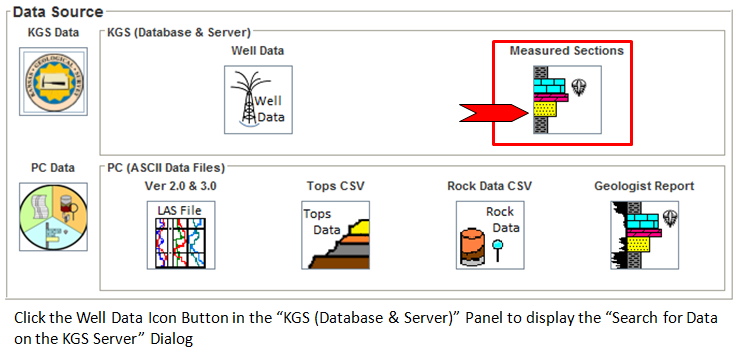
The Search for KGS (Kansas Geological Survey) Measured Sections Dialog assists the user in locating a set of measured sections (precise measurements and descriptions of a cross section of an outcrop or roadcut) for selected counties in Kansas. The data are based on archived materials from the Kansas Geological Survey, with sections created from 1900's to 1950's. The graphic columns have been scanned or scanned and traced from the original copies, and the descriptions have been typed into the Kansas Geological Survey's Database.
Current stratigraphic nomenclature may be different than that presented in the KGS Database, and some of these outcrops may no longer exist or may not be accessible.
| Select a button from the following list to view Help pages. | ||
|---|---|---|
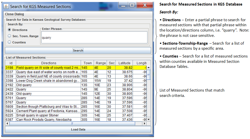
Search By: |
||
 |
Search By: Partial Phrase within the Directions / Location Column. | |
|
|
Search By: Section-Township-Range | |
|
|
Search By: Kansas County | |
Author: John R. Victorine jvictor@kgs.ku.edu