Pawnee Rib (114)
Kansas Geological Survey, Bulletin 90, Part 6, Page 3 of 3
Back--Letters D through O...
Pawnee Rib (114) |
 |
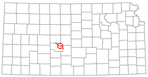
A pre-Mississippian structure in Pawnee County, which may be regarded as a part of the Ellis arch, is called Pawnee rib.
The name Pawnee rib was introduced by Koester (1935, p. 1419): "The broad area in Pawnee County in which the 'Siliceous lime' underlies the Pennsylvanian represents a third rib running approximately parallel with the other two. . . . not much is known about this Pawnee rib." The other two ribs mentioned in the quotation are the Russell and Rush, which are listed in this index.
Pfeifer Anticline (115) |
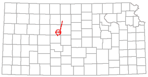 |
Pfeifer is the name of an anticlinal fold discernible in Cretaceous rocks in Ellis and Russell Counties.
The Pfeifer anticline was named by Bass (1926, p. 42): "The most pronounced structural feature of Ellis County is a northeastward-trending fold that crosses the southeast corner of the county and extends into Russell County. This fold, here called the Pfeifer anticline, appears to be in general alignment with the Fairport-Natoma anticline of Russell and Osborne counties. . . . Like the Fairport-Natoma anticline, it is steeper on the west flank, where dip readings as great as 3 1/2 degrees were noted."
Bass (1926, p. 43) described several other unnamed folds in Ellis County.
Pittsburg anticline is the name of an anticlinal fold in Crawford County. It was measured in outcropping Cherokee beds of Desmoinesian age.
The Pittsburg anticline was named and described by Pierce and Courtier (1938, p. 53): "The most prominent structural feature is the Pittsburg anticline, which is here named from the town of Pittsburg in southeastern Crawford county. It has a maximum structural relief of about 70 feet and ranges in width from 4 miles in the southeastern part to 2 miles in the northwestern part. The anticline extends for an undetermined distance in Missouri. It enters Kansas near the southeast corner of T. 30 S., R. 25 E., trends northwestward to Capaldo, and then swings west-northwest to Girard. In T. 30 S., R. 25 E., the crest of the anticline plunges to the northwest, but beyond Capaldo it rises again and the anticline is a narrow, slightly domed fold which has a minimum closure of about 20 feet."
Prairie Plains monocline is the name applied to a somewhat indefinite area embracing eastern Kansas and parts of neighboring states in which outcropping Pennsylvanian and Permian rocks dip westwardly and north- westwardly.
According to Prosser and Beede (1904, p. 5): "This term is applied to all of the area of eastern Kansas and parts of adjoining States, because the rocks dip generally to the north of west." The name Prairie Plains monocline has come into general usage and was summarized (Jewett, 1949, p. 59): "In eastern Kansas and parts of neighboring states, outcropping Permian and Pennsylvanian rocks dip gently in a general westward direction. This regional dip, which generally is about 20 feet per mile, is modified locally, especially in the area of the Nemaha anticline. Because of this regional dip, the area is called the Prairie Plains monocline. Outcropping Pennsylvanian rocks dip gently outward from the Ozark dome, and Permian beds, whose strike is more nearly directly north-south, dip westward into a Mesozoic basin. Hence the so-called monocline is a large, more or less indefinitely limited, tectonic element. It is chiefly post-Permian in age. Overstep of Cretaceous rocks on beveled Permian beds in eastern Kansas and on beveled Pennsylvanian rocks in southeastern Nebraska and southwestern Iowa indicates pre-Cretaceous age for the Prairie Plains structure."
The name Prairie Plains is sometimes used as that of the land form that occupies the same area as the tectonic unit, but Osage Scarped Plains is the more common name for most of the eastern Kansas area.
A buried hill of Precambrian quartzite overlain by gently arched Pennsylvanian beds and flanked by gently dipping Cambro-Ordovician strata in the western part of T. 16 S., R. 11 W., Barton County, is called Prusa Hill (Walters, 1946, p. 671).
Walters (1946) and Walters and Price (1948) discussed six buried hills of the Kraft-Prusa oil district in great detail in comprehensive papers that describe the geologic events that produced them and the overlying structures, and discussed-the role of the structures in oil accumulation.
The Prusa North hill (Walters, 1946, p. 671) is a buried hill of Precambrian rock in the northwestern part of T. 16 S., R. 12 W., Barton County. It is a part of the Kraft-Prusa structure in the Barton arch of the Central Kansas and Ellis arch area.
The term Pryor basin has been used for the site of accumulations of basal Pennsylvanian (Cherokee, Desmoinesian age) sediments in southeastern Kansas and northeastern Oklahoma. It may be regarded as a synonym of Cherokee basin.
Pryor was first used as a structural name by Lowman (1933): "The lower Cherokee was deposited in the McAlester basin and in a comparatively narrow, elongated basin in northeastern Oklahoma, here called the Pryor basin. The Pryor basin is continuous with but separated by a saddle from the Kansas extension of the Forrest City basin of northwestern Missouri."
The Forest City and Cherokee basins are separated by the Bourbon arch; and unless Lowman regarded the Forest City basin (the spelling Forrest City in Lowman's paper is regarded as a typographical error) as being limited on the south by the Chautauqua arch, the Pryor basin is the same as the Cherokee. It may be noted that Cherokee sediments are not diminished in thickness in the area of the Chautauqua arch as they are on the Bourbon arch, nor is there evidence that any thick stratigraphic units in the Cherokee section are absent on the Chautauqua arch. Hence the Chautauqua arch is not to be regarded as a boundary between sedimentary basins that existed while Cherokee beds were being deposited.
Other structures mentioned in the paragraph above are listed and discussed elsewhere in this index.
Rainbow Anticline (121) |
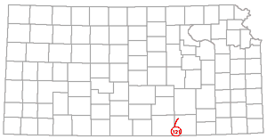 |
The name Rainbow anticline has been applied to the structure that contains the Rainbow Bend oil pool, Cowley County.
The name Rainbow was used as a structural term by Snow and Dean (1929, p. 54): "The subsurface structure of this district, as shown on the general map in 50-foot contours on the top of the 'Mississippi lime' indicates an axis of folding from the Clarke field in Sec. 6, T. 31 S., R. 4 E., extending south through the Rainbow Bend field to Blackwell. . . . Along this general axis of folding, isolated structures of several types occur, of which the Graham and Rainbow structures are fair types."
The axis of folding referred to in the quotation apparently is a short distance east of and approximately parallel to the axis of the Nemaha uplift, a trend of folding that is fairly persistent for a great distance in the eastern edges of the Forest City and Cherokee basins. Bass (1929, fig. 11) showed the structure on the top of the "Mississippi lime" in the Rainbow Bend oil field, T. 33 S., R. 3 E.
The Ralston is a syncline in northwestern Butler County.
Fath (1921, p. 160) mentioned the Ralston syncline in sec. 36, T. 25 S., R. 4 E. It is a minor structure on the El Dorado anticline, which is a prominent part of the Nemaha anticline. Fath named and described several other structures in the area of the El Dorado oil and gas field in Butler County.
Ramsey is the name of a small synclinal fold that separates the Robinson and Chelsea domes, parts of the El Dorado anticline. The El Dorado structure is a prominent "high" on the Nemaha anticline. It is in Butler County.
The Ramsey syncline was named by Fath (1921, p. 73). It lies principally in the W2 sec. 2, T. 24 S., R. 5 E. Oil is produced from an outlier of Mississippian limestone in this depression.
A domelike fold observed in outcropping rocks of early Permian age in northwestern Cowley County is called Redbud. It may be regarded as a minor structure on the Nemaha anticline.
The Redbud dome was named by Bass (1929, p. 180): "Redbud dome. Another dome-shaped fold occurs about 3 miles northeast of the Udall pool, in sec. 10, T. 30, R. 3 E., in line with the 'granite ridge' . . . The Winfield limestone dips westward beneath overlying beds in the east half of section 14 but again rises to the surface in the north-central part of section 10, near the crest of the dome." The granite ridge mentioned in the quotation is the Nemaha anticline.
The Robinson dome is a part of the El Dorado anticline. It is almost entirely in sec. 3, T. 25 S., R. 5 E., Butler County.
The Robinson dome was named by Fath (1921, p. 70): "The altitude of its apex is about 1,375 feet, the lowest of the El Dorado domes, and its closure is probably less than 25 feet."
The name Rose dome is applied to a rather large dome in southern Woodson County. The Rose dome was discussed by Ley (1924, p. 450): "The Rose dome located in Secs. 18 and 19, T. 26 S., R. 16 E., and Secs. 13 and 24, T. 26 S., R. 15 E., is one of the most-marked surface structures in the eastern tier of counties. It has at least 80 feet of surface 'closure,' covering fully ten square miles. Subsurface structure on the 'Oswego' lime and the attitude of the upper surface of the pre-Pennsylvanian, which has shifted southward, are quite similar to the surface."
Ley (1924, p. 450) noted that the section of sedimentary rocks in the area has the normal thickness for the district and that this indicates wholly post-Pennsylvanian movement. It is noteworthy that coarse-grained granite is exposed in sec. 13, T. 26 S., R. 15 E, This granite is more or less commonly interpreted as occurring in a small dike (Moore and Landes, 1937). Igneous rock "apparently an altered dike rock" (Knight and Landes, 1932, p. 7) and peridotite (Twenhofel and Bremer, 1928, p. 758) have been reported in the subsurface in this area. The Silver City dome, an area in which metamorphic and igneous rocks crop out, is a short distance west and slightly south of the Rose dome. Small amounts of gas but no oil have been found in the Rose dome. Knight and Landes (1932) expressed the opinion that the Neosho Falls, Rose, and Silver City domes resulted from arching of sedimentary rocks above laccoliths.
Rush Rib (127) |
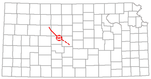 |
The term Rush rib refers to a structural high in Ordovician and older rocks in the Barton and Ellis arch areas.
The term Rush rib was used by Koester (1935, p. 1419): "Within the nucleus are two somewhat-narrow bands, marked by the outcrop of Precambrian rocks, which may be called the 'Russel rib' and the 'Rush rib.' These are true structural 'highs' in the Ordovician and pre-Ordovician rocks, as well as being topographic monadnocks. . . . From southeastern Barton County the Rush rib trends northwestward to the northwestern part of Rush County, whence it turns slightly northward through western Ellis County and eastern Trego County into Graham County."
The major pre-Mississippian structure in central Kansas that is commonly known as the Barton arch (Barwick, 1928) and as the Central Kansas uplift (Morgan, 1932) was first called Russell arch.
The name Russell arch was first used by Denison (1926): "There is here a large area, the limits of which are as yet undefined, where Ordovician is encountered directly beneath Pennsylvanian beds, with a large part of the Pennsylvanian which should correspond to the Cherokee of eastern Kansas missing. . . . I believe that the Welch chert . . . was derived mainly from an uplift, . . . the Russell arch."
Russell Rib (129) |
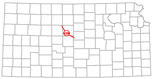 |
The somewhat unusual structural term Russell rib refers to a part of the Barton arch or Central Kansas uplift, perhaps more properly of the Ellis arch.
This name was used by Koester (1935, p. 1418-1419). In discussing pre-Mississippian areal geology he called an area within the large U-shaped band of Simpson outcrop the nucleus of the Central Kansas uplift. In this area Pennsylvania beds lie on Arbuckle limestone and older rocks except for a Simpson outlier in Rooks and Ellis Counties (Koester, 1935, fig. 2). He wrote (p. 1419); "Within the nucleus are two somewhat narrow bands, marked by the outcrop of Precambrian rocks, which may be called the 'Russell rib' and the 'Rush rib.' These are true structural 'highs' in the Ordovician and pre-Ordovician rocks. . . . The Russell rib extends in a northwest direction from southwestern Ellsworth County across southern Russell County to the vicinity of Gorham, whence it curves more northward through the Fairport oil field, thence northwestward across a small part of Ellis County into Rooks County. . . . the effect of the warping which caused the Russell rib is apparent in the Geneseo pool of north-central Rice County, where Pennsylvanian rests on a very thin section of Simpson."
It may be noted that this structural fold may be regarded as a part of the Ellis arch, the older structure that has more or less the same position as that of the Barton arch, but with an axis extending in a more northwesterly direction (Moore and Jewett, 1942, figs. 6-8). Attention also is called to the Geneseo structure, which is listed in this index.
Salina Basin (130) |
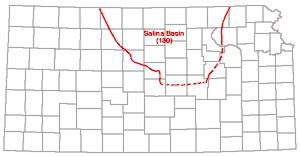 |
The Salina basin occupies an area in north-central Kansas between the northern end of the Nemaha anticline and the Central Kansas uplift (Barton arch). It is an area of depressed Mississippian and older rocks between the two anticlinal areas and is bounded on the south by an unnamed arch-like structure which separated it from the Sedgwick basin. Its age is post-Mississippian. Middle Pennsylvanian sediments were deposited on peneplaned Mississippian rocks there, and at the end of post-Mississippian beveling 350 feet of Mississippian limestone remained in the deepest part of the basin.
The Salina basin was named by Barwick (1928, p. 179): "The Salina basin is herein defined as the pre-Pennsylvanian syncline bounded on the east by the Nemaha granite ridge, on the southwest by the Barton arch, and on the south by the saddle between the Chautauqua arch and the Barton arch."
The Nemaha "granite ridge" of Barwick's definition is now commonly called Nemaha anticline and the Barton arch is more generally known as the Central Kansas uplift (see Barton arch and Central Kansas uplift). Barwick did not differentiate the post-Mississippian Barton arch from its ancestral structure now called Ellis arch. More properly the Chautauqua-Ellis axis or the Central Kansas arch separated the North Kansas and Southwest Kansas basins, which are pre-Mississippian structures. Thinning of Mississippian rocks in McPherson and Marion Counties (Lee, Leatherock. and Botinelly (1948, pl. 8) reveals the post-Mississippian separation of the Salina and Sedgwick basins. On this map the northern boundary of the pre-Pennsylvanian Salina basin has been mapped by the wedging out of Mississippian limestones along a line crossing Clay, Cloud, Republic, Jewell, and Smith Counties. More recent data reveal that an arm of the basin extends northward into Nebraska west of the Nemaha and the Barneston anticlines (Wallace Lee, personal communication).
The stratigraphy and structural development of the Salina basin area have been discussed comprehensively by Lee, Leatherock, and Botinelly (1948), and briefly by Moore and Jewett (1942, p. 437), Jewett and Abernathy (1945, p. 43), Jewett and Smith (1943), and Jewett (1949, 1950). The first named authors described the following five principal periods during which folding took place within the area: (1) late Cambrian to early Ordovician, (2) St. Peter to Mississippian, (3) Mississippian to Permian, (4) post-Permian and pre-Cretaceous, and (5) post-Cretaceous.
Two domes forming an "amoeboid" structure in southern Mitchell County have been called Salt Creek Twins.
Landes and Ockerman (1933, fig. 2) showed the centers of the "twins" in the SE sec. 30 and in the SE sec. 29, T. 9 S., R. 7 W. Closure, presumably measured in surface Cretaceous rocks, according to a map published by Landes and Ockerman and credited to T. H. Alien, of the west dome amounts to about 50 feet. and of the east dome about 83 feet. These structures are believed by Landes and Ockerman to be due to Cretaceous deposition conformable to the uneven surface on eroded Permian rocks.
The term Scott basin has been used for an area in Scott County described primarily as a physiographic division, but attributed chiefly to folding that took place prior to the accumulation of enduring Tertiary sediments.
Waite (1947, pp. 18, 35) referred to the Scott basin as a physiographic division but stated: "Prior to the deposition of Tertiary sediments there was a period of folding. . . . A broad asymmetrical trough, with its axis extending from Garden City to Scott City and northward, was developed." Hence the axis of the trough that underlies and is chiefly accountable for the Scott basin as the term was used by Waite and by Latta (1944, p. 21) coincides with the axis of the Shallow Water basin as denned earlier by Moss (1933). It seems that, as a structural term, Scott should be regarded as a synonym of Shallow Water.
Sedgwick Basin (132) |
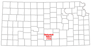 |
The Sedgwick basin, regarded as one of the major post-Mississippian structural provinces in Kansas, occupies an area in central Kansas southward from McPherson and Marion Counties. It is west of the Nemaha anticline and south of a low arch-like structure that marks the southern boundary of the Salina basin, and west of a similar separation from the Dodge City basin or embayment.
The Sedgwick basin was named by Moore and Jewett (1942, p. 487, fig. 8): "A basinal area lying southeast of the Central Kansas Uplift is here differentiated as the Sedgwick Basin, partly because it is more or less separated geographically from the continuations northward and southward in contiguous basinal areas and partly because of the general nature of geologic structure and production in [oil] fields of the region."
The Sedgwick basin is to be regarded as post-Mississippian in age because it was formed chiefly after Mississippian rocks were deposited and before burial of their eroded surface below Pennsylvanian sediments. Rocks of the Cherokee group (middle Pennsylvanian) lie on Mississippian limestones there, but rocks older than Mississippian are next below Pennsylvanian beds in neighboring parts of the Nemaha anticline and Central Kansas uplift.
Thinning of Mississippian rocks in McPherson and Marion Counties (Lee, Leatherock, and Botinelly, 1948, pl. 8) indicates post-Mississippian separation of the Sedgwick and Salina basins.
Seisgood is the name that has been given to a small dome in Wallace County, a part of an anticlinal fold that is called Willow Creek anticline.
The name was given by Elias (1931. pp. 200-201): "The main structural highs, which constitute the Willow Creek structure, are Western anticline on the west, Seisgood dome on the north, and Bat anticline on the south." According to Elias the Willow Creek anticline is in T. 13 S., Rs. 41 and 42 W. and is a part of what has been called the Weskan anticline.
The Shallow Water basin may be regarded as both a structural and topographic basin.
According to Moss (1933, p. 1, fig. 2) the Shallow Water basin lies in central southern Scott and the adjacent part of Finney County and derives its name from the fact that water is obtained at depths ranging from 20 to 75 feet and that there is no surface drainage from the area. The town of Shallow Water is near the central part of the basin as mapped by Moss (1933, fig. 2). A cross section by Moss (1933, fig. 1) shows beds of clay, silt, sand, and gravel dipping into the basin from two sides, presumably east and west. Structure in underlying Cretaceous rocks is not shown.
Latta (1944, p. 21) referred to the southern part of the Shallow Water basin, as defined by Moss, as the Finney basin, and the northern part as the Scott basin, but stated that the two are continuous. Latta (1944, fig. 2) called the Finney basin a physiographic division but in a cross section (fig. 8) showed synclinal structure in Cretaceous rocks that are overlain by Pliocene and Pleistocene beds that are represented as lying in a horizontal position. Earlier Smith (1940, p. 138) observed the structural nature of the Finney basin: "It obviously can not be explained as a product of stream erosion, and consequently can be attributed only to post-Ogallala downwarping." Waite (1947, p. 18) referred to the Scott basin as a physiographic division, but stated (Waite, 1947, p. 35): "Prior to the deposition of Tertiary sediments there was a period of folding. . . . A broad asymmetrical trough, with its axis extending from Garden City to Scott City and northward, was developed." Hence the axis of the trough mentioned by Waite coincides with the axis of the Shallow Water basin. Smith (1940, p. 138) described the Finney basin also as having an axis extending from Garden City to Scott City. Hence, seemingly both Finney and Scott as structural terms may be regarded as synonyms of Shallow Water; Shallow Water may be regarded as a geographic name and preferred term.
The name Sharon Springs anticline is applied to an anticlinal fold in Wallace County. It is discernible in outcropping Cretaceous and Tertiary rocks.
The Sharon Springs structure was discussed by Elias (1931, p. 196): "Two meridianal ridges . . . can be recognized in Wallace County. One . . . can be called the Weskan . . . anticline. . . . The other . . . runs slightly west of Sharon Springs and can be called the Sharon Springs ridge or anticline."
The name Shumway dome is applied to a part of the El Dorado anticline in the El Dorado oil field, Butler County. The El Dorado anticline is part of the Nemaha anticline.
The Shumway dome was named by Fath (1921, p. 67): "This dome is located principally in the northeast corner of T. 26 S., R. 4 E. . . . It is slightly elongated in a northeasterly direction, extending from the SW sec. 31, T. 25 S., R. 5 E., on the northeast, to sec. 14, T. 26 S., R. 4 E., on the southwest, a distance of about three miles. Its width ranges from 1.5 to about 2 miles."
At the surface the Shumway dome like the other parts of the El Dorado anticline can be measured in lower Permian rocks and has about 30 feet of closure (Fath, 1921, pl. 1). In the "Stapleton zone" which is the sub-Pennsylvanian surface of Ordovician rocks, which were elevated and eroded before burial, it is much more steeply denned. The most prolific wells in the El Dorado oil field are on the Shumway dome. The "Stapleton zone" is the reservoir.
The Silver City dome is in southwestern Woodson and northwestern Wilson Counties. The first published map of the structure is one by Twenhofel and Edwards (1921, p. 65), but metamorphic rocks that occur at the surface there were described by Mudge (1880) and by Hay (1833).
Knight and Landes (1932, p. 3) discussed this structure: "The anticline is elliptical in plan with its major axis trending nearly due west. The greater part of the structure lies in Sec. 36, T. 26 S., R. 14 E.; Sec. 1, T. 27 S., R. 14 E.; Secs. 31-33, T. 26 S., R. 15 E.; and Secs. 4-6, T. 27 S., R. 15 E. The north flank of the dome has a short but prominent northeastward trending spur, which extends from Section 32 into the southern half of Section 29. This 'bulge' of the ellipse is especially interesting, for here occurs a mass of hydrothermally metamorphosed rocks . . ."
Bass (1936, pl. 7) showed the center of the structure in the vicinity of the Cen. S. line sec. 32, T. 26 S., R. 15 E.
The Silver City dome is of unusual interest because of the presence of outcropping quartzite derived from sandstone of early Virgilian age and of outcropping and shallow abundantly micaceous rock that is believed to be igneous. Oil was discovered on the north flank of the dome in the SE SE SE sec. 19, T. 26 S., R. 15 E., in 1946 (Jewett, 1949, pp. 293-294). Knight and Landes (1932) expressed the opinion that the Neosho Falls, Rose, and Silver City domes are the result of doming of stratigraphic rocks above laccoliths.
The name Slick-Carson is applied to a small dome, measured in subsurface rocks that underlie the Slick-Carson oil field in T. 32 S., R. 3 E., Cowley County.
Bass (1929, p. 124, Kg. 7) showed the apex of the Slick-Carson dome in sec. 19, T. 32 S., R. 3 E. and according to him the horizon at the base of the Fort Scott limestone is much less steeply folded than the pre-Chattanooga surface and the restored upper surface of the Mississippian limestone.
Smoky syncline is the name that has been given to a synclinal fold in western Wallace County. It is discernible in outcropping Cretaceous rocks.
The name was applied by Elias (1931, p. 200): "The Smoky Hill river flows through a syncline, which closes the Willow creek structure on the south. This syncline is named the Smoky syncline." According to Elias (1931, p. 200) the Willow Creek anticline lies in T. 13 S., Rs. 41 and 42 W.
Southeast Nebraska arch is the name of a large pre-St. Peter (late early Ordovician) structure in northeastern Kansas and southeastern Nebraska. The name was first applied by Lee (1943, p. 102).
Lee, Leatherock, and Botinelly (1948, fig. 2, pp. 122-123) showed the Southeast Nebraska arch extending from Nebraska into Washington, Marshall, Nemaha, Clay, Riley, and Pottawatomie counties, Kansas, and wrote: "Also, at that time a broad beveled southward plunging arch, the Southeast Nebraska arch, extended from southeastern Nebraska southward across Kansas more or less parallel to the contemporaneous Ozark basin." Usage of the term Ozark basin is discussed elsewhere in this index.
Southwest Kansas Basin (142) |
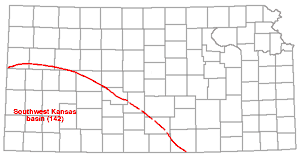 |
The name Southwest Kansas basin is applied to a major pre-Mississippian structural province in southern Kansas.
The Southwest Kansas basin was named by Moore and Jewett (1942, p. 486, fig. 7): "Southwest of the Elis Arch and west of the Chautauqua Arch is a basinal area of pre-Mississippian date which is designated as the Southwest Kansas Basin. Little is known except that 'Hunton' and a thick section of Ordovician rocks is present in this region." In the light of present knowledge it seems that Devonian and Silurian rocks ("Hunton") are absent in southwestern Kansas and that Mississippian beds overlie at least locally the Viola limestone.
As interpreted by Edson (1947), the Champlin Refining Company No. 1 Becker well, sec. 34, T. 28 S., R. 29 W., Gray County, penetrated about 300 feet of Ordovician rocks above the Eminence dolomite which lies at about 6,500 feet below the surface. The deepest well that has been drilled in Kansas is the Stanolind Oil and Gas Company No. 1 Pearl Feather, sec. 15, T. 35 S., R. 33 W., Seward County. The following datum points are reported: top of Mississippian rocks, 6,200 feet; top of Simpson, 7,965 feet; top of Arbuckle rocks, 8,013 feet. The total depth is 8,043 feet. The elevation of the well is reported as 2,823 feet. According to Clair and Edson (1950, p. 90): "In far western Kansas the Arbuckle group varies from 249 feet with only Cambrian beds present, to a maximum of 645 feet made up of both Ordovician and Cambrian beds."
The major pre-Mississippian basins in Kansas are the North Kansas basin and the Southwest Kansas basin, which were separated by the Central Kansas arch or the Ellis-Chautauqua axis.
An inferred dome in Cretaceous shale in southwestern Wallace County has been called Stockholm dome.
The name Stockholm dome was introduced by Elias (1931, p. 197): "In the southwest corner of Wallace County, on the high, slightly dissected plateau, there is an area of about nine square miles along the south fork of Ladder creek in which all the wells dug or drilled to the top of the Pierre shale are dry. . . . It seems to the writer that the absence of water in the wells can be accounted for by the presence of a very low and broad structural hill (Stockholm dome) of shale covered with Ogallala and loess."
The area of the Stockholm dome is shown by Elias (1931, pl. 42) as an area "with no sheet water."
Stockton Anticline (144) |
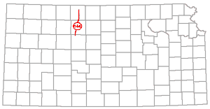 |
The name Stockton anticline has been used for a fold, discernible in Cretaceous rocks in Ellis, Rooks, and Phillips Counties.
The Stockton anticline was named by Bass (1926, p. 88, pl. 7): "A rather pronounced and extensive series of structural 'highs' extend from northwestern Ellis county north-northeastward across Rooks county, passing a few miles west of Stockton and thence into Phillips county near Phillipsburg. It is possible that the nose crossing the southeast corner of Trego county is the southward continuation of the Stockton fold or one in echelon with it." On the accompanying structural map Bass used the name Stockton anticline for the axis of the series of "highs" that he described.
The Syracuse anticline is mainly in Hamilton County. It is a faulted southeast-northwest trending fold that is discernible in Cretaceous rocks.
The Syracuse anticline was discovered by Darton (1918, p. 5, fig. 4) and according to Bass (1926, p. 88): ". . . the Syracuse anticline, in Hamilton county, is the most pronounced feature and is shown here much as presented on Darton's map, although some changes have been made." Bass (1926, pl. 7) showed the axis of the fold extending from northwestern Grant County across the northeastern part of Stanton County and across Hamilton County in a southeast-northwest direction. It is now recognized that a fault forms the southern margin of this structure. The presence of the fault was suspected by Smith (1940, pp. 136-137) and was proved conclusively by Latta (1941, p. 25, pl. 4). The fault was discussed in detail by McLaughlin (1943, p. 124) who wrote: "A test hole was drilled on the Hamilton-Stanton county line at a point about 1.2 miles southeast of an outcrop of the Dakota formation. In this test hole the Dakota formation was encountered at a depth of 230 feet. The altitude of the top of the Dakota formation is more than 300 feet higher at the outcrop than in the near-by test hole."
The Table Rock anticline is the conspicuous anticline in Permian and Pennsylvanian rocks in southeastern Nebraska and northeastern Kansas and constitutes a part of the more extended Nemaha anticline.
The Table Rock anticline was named by Condra and Bengston (1915, pp. 25, 39) and was discussed by Condra (1927, pp. 14-15): "It is a large structure extending from northwest of Talmage [Nebraska] southward . . . past Du Bois and through Kansas to beyond Wamego and the Kansas River. Its highest point is at the Kansas line where erosion has removed more than 100 feet of Permian beds and cut through the Pennsylvanian . . . a vertical distance in the general section of about 700 feet." And ". . . the known length in Kansas is 60 miles. A buried granite ridge, . . . the Nemaha Mountains . . . , is not far below the surface in parts of this anticline."
Table Rock anticline should be regarded as a proper designation of a part of the longer Nemaha anticline. The Burns dome, El Dorado anticline, and Elmdale anticline are other high parts of the major structure which also were discovered from the uplift's conspicuous local expressions in outcropping rocks. The syncline west of the Table Rock anticline is called Irving and the syncline on the east is the Brownville; the fault in the east flank of the Table Rock anticline near the Kansas-Nebraska border is called the Humboldt fault. These structures are listed in this index.
The Theta syncline is a synclinal fold that modifies the El Dorado anticline, which is a prominent part of the Nemaha anticline in Butler County. The Nemaha anticline crosses Kansas and extends into Nebraska and Oklahoma.
The Theta syncline was named by Fath (1921, p. 73): "A pronounced depression . . . crosses leases of the Theta Oil Company in secs. 16 and 17, T. 25 S., R. 5 E., and separates the Chesney dome from the Wilson dome. It is a westward extension of the deep basin of the Walnut syncline . . . ."
The name Tipton anticline has been given to a rather pronounced northward-plunging anticlinal fold in western Mitchell County. It is discernible in outcropping Cretaceous rocks.
The name Tipton was applied by Landes (1930, p. 43, pl. 10) to a fold represented on a structural geologic map of Osborne and Mitchell Counties. He left the structure unnamed on the map but in the next referred to it as the Tipton anticline: "The Tipton anticline is not apparent on the subsurface map, but this may be due to lack of control points in southwestern Mitchell County." Landes (1930) mapped and described several unnamed surface and subsurface structures in Osborne and Mitchell Counties and Wing (1930) mapped and described several structures in Cloud and Republic Counties.
A domelike structure interpreted from local dip readings on Cretaceous beds in the southwestern part of T. 14 S., R. 36 W., Logan County,has been called Twin Buttes anticline.
The structure was named by Lupton, Lee, and Van Burgh (1922, p. 79, pl. 2) who published a map of the fold interpreted from dips taken on Niobrara chalk. The center of the dome lies in the southwestern part of sec. 31, T. 14 S., R. 36 W. Faults are shown on the southwestern flank in the N2 sec. 1, T. 15 S., R. 37 W. The structure as revealed by dips was regarded as a minor dome on the southern extension of the Black Hills arch (Cambridge anticline). The Cambridge anticline and Black Hills arch are discussed elsewhere in this paper.
Valley Center Anticline (150) |
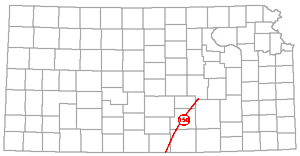 |
A deeply buried structure in Sedgwick County that contains the Valley Center oil pool (produces from the Viola) is known as the Valley Center anticline.
McCoy and Keyte (1934, p. 296, fig. 3) published a cross section of the Valley Center anticline and discussed it in reference to oil accumulation. The fold is developed principally in Mississippian and older rocks and probably is faulted. It may be regarded as lying in the long structural trend known as the Bluff City anticline.
Virgil anticline is used as a structural name to designate the domelike structure that contains the Virgil oil pool (produces from Mississippian rocks), Greenwood County.
Bass (1936, p. 59), in discussing structures in Greenwood County, wrote: "The Virgil anticline that is largely in T. 24 S., R. 12 E., the anticline in T. 23 S., R. 13 E., and that in T. 24 S., Rs. 13 and 14 E.; and T. 23 S., R. 14 E., and the anticline that lies close to the range line between T. 22 S., R. 12 E., and T. 22 S., R. 13 E., are other prominent folds." According to the usage of terms by some geologists the Virgil structure is the northern part of a long fold called Beaumont anticline.
Beekly (1929 p. 146) referred to the Virgil structure: "The Virgil structure is a textbook example of a closed anticline which makes a perfect trap for oil accumulation. . . ." The structure was mapped on outcropping Lecompton limestone and on the top of the buried Mississippian rocks (Beekly, 1929, figs. 1-2) and according to Beekly (p. 145): "The Virgil pool is located on a surface structure having more than 60 feet of closure with its top in the west-central part of Section 23 and its long axis extending approximately from the center of Section 12 to the center of Section 27 [T. 24 S., R. 12 E.]."
Voshell Anticline (152) |
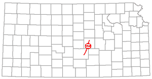 |
The Voshell is an anticline in McPherson and Harvey Counties that is approximately parallel to the Nemaha anticline which lies about 50 miles to the east; it is approximately in line with the Abilene anticline which is farther north in Kansas. The structure extends from T. 18 S., R. 2 W. to T. 24 S., R. 4 W.
The Voshell anticline and its development were thoroughly discussed by Bunte and Fortier (1941) who published also excellent cross sections and maps showing the structure. According to those geologists (p. 110): "The Voshell trend, consists of an anticlinal fold extending in a northeasterly direction and plunging southwest. A reverse fault with a throw of about 400 feet is present on the west side of this anticlinal structure. The strike of the fault is almost parallel with the axis of the Voshell anticline and it is situated approximately 1/4 mile west of the axis. It appears that the major structural uplift took place in post-Mississippian time and minor movements followed in late or post-Permian time. It appears that no structural movement had taken place here before Kinderhookian deposition. In all probability the Voshell anticline was formed contemporaneously with the forming of the Nemaha Granite ridge of east-central Kansas." The granite ridge mentioned in the quotation is the Nemaha anticline.
The McPherson, Chindberg, Johnson, Voshell, Nikkel, Hollow, and Burrton oil pools are associated with the Voshell structure. All oil accumulations there, with the exception of the Nikkel pool, which is regarded as a stratigraphic trap. are the result of closed anticlinal structures.
The name Walnut syncline applies to the synclinal fold east of the El Dorado anticline in Butler County.
The Walnut syncline was named by Fath (1921, p. 66): "The Eldorado anticline is limited on the east by the pronounced Walnut syncline, which is located in the main valley and west branch of Walnut river, after which it is named. This syncline is a rather straight trough extending from beyond the south border of the Eldorado district to the east-central part of T. 25 S., R. 5 E. Here it terminates in a slightly accentuated depression from which minor synclines radiate to the northwest and east. The maximum vertical differences between the crest of the Eldorado anticline and the trough of the Walnut syncline is about 180 feet."
It is to be noted that there is a deep trough bordering the Nemaha anti- cline, of which the El Dorado anticline is a part, on the east along its entire length. This condition is represented in various published cross sections that show conditions along east-west sections in eastern Kansas (Kellett, 1932; Moore, 1936; Jewett and Abernathy, 1945, pls. 1-3; Jewett, 1949, pl. 3). This situation is strongly expressed in the pattern of outcropping rocks northward from northern Wabaunsee County, where there is a broad inlier of Permian rocks (Moore and Landes, 1937). The syncline there is called Brownville. The "180 feet difference in elevation" in Butler County is measured in surface rocks. In the subsurface the difference is much more. In Butler County Precambrian rocks are about 1,600 feet lower in the Walnut syncline than in the El Dorado anticline. In northern Kansas the crest of the granite core of the anticline is nearly 3,000 feet higher than are Precambrian rocks a few miles to the east.
Weskan is the name of an anticlinal fold in western Wallace County. It is discernible in outcropping Cretaceous rocks.
The Weskan anticline was named by Elias (1931, p. 196): "Two meridianal ridges, each representing a chain of several uplifts that are stretched along a north-south direction, can be recognized in Wallace County. One runs through Weskan and can be called the Weskan structural ridge or anticline."
The Stockholm dome, which is listed in this report, is an inferred structure that was described by Elias as a part of the Weskan anticline. The Weskan fold and other structures in Wallace County are shown on a structural geologic map of the county by Elias (1931, pl. 42).
The name Western anticline has been given to a part of the Willow Creek anticline, Wallace County.
According to Elias (1931, pp. 200-201): "The main structural highs, which constitute the Willow Creek structure, are Western anticline on the west, Seisgood dome on the north and Bat anticline on the south. . . . The highest elevations of Western and Bat anticlines are marked by the 4,020-foot contour."
The location of the Willow Creek anticline is given as T. 13 S., Rs. 41 and 42 W. (Elias, 1931, p. 200). It is a part of a structure that has been called Weskan anticline.
The term Western Kansas basin was introduced recently as a structural term. It designates a regional post-Permian basin in western Kansas.
On a map by Wallace Lee (Moore and others, 1951, fig. 46) the western Kansas basin is shown by generalized 250-foot contours on the Stone Corral dolomite (Leonardian). The caption in part is: "Western Kansas basin, evolved from Hugoton embayment . . . . This basin is now the result of post-Dakota movements that tilted the Hugoton embayment northward toward a large basin in western Nebraska."
The name Whitewater nose was applied by Fath (1921, p. 66) to a southwesterly extending part of the Shumway dome which is a part of the El Dorado anticline, a local "high" on the Nemaha anticline, in Butler County.
According to Fath (1921, p. 67): "A plunging anticlinal nose, apparently related to the Shumway dome, from which it offshoots to the south, is located in secs. 22, 27 and 33, T. 26 S., R. 4 E. This plunging fold is called the Whitewater nose."
The Whitewater nose is discernible in outcropping rocks of early Permian age. It is bordered on the east by a very sharp depression, the Hammond syncline.
The Willow Creek anticline is in Wallace County. It can be measured in surface Cretaceous rocks.
The Willow Creek anticline was described by Elias (1931, p. 200): "The Willow Creek anticline lies in the townships 13 south of ranges 41 and 42 west, Wallace county, Kansas. The center of the structure is five miles north-northeast of Weskan. On the south the structure is bordered by the valley of South Smoky Hill river. . . . The northern closure of the structure lies in the divide between Willow creek and Schoolhouse draw."
As defined by Elias the Willow Creek anticline is a part of a larger fold, the Weskan anticline.
The Wilson dome is a part of the El Dorado anticline, a prominent part of the Nemaha anticline in Butler County.
The Wilson dome was named by Fath (1921, p. 70): "This dome is elongated with a west-northwesterly trend, and although centering in sec. 8, T. 25 S., R. 5 E., includes also parts of secs. 4, 5, 6, 7, 9, 16 and 17 of the same township. . . . Its closure probably exceeds 40 feet."
Wilson-Burns Element (158) |
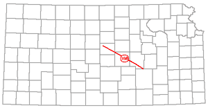 |
The name Wilson-Burns element has been proposed for a northwestward trend of domelike structures in pre-Mississippian rocks that extends from the Burns dome in Butler and Marion Counties to eastern Russell County.
The name Wilson-Burns was introduced as a structural term by Koester (1935, p. 1419): "Two high areas of 'Siliceous lime' cropped out in early Pennsylvanian time northeast of the nucleus of the uplift, one in central Ellsworth County near Ellsworth, the other at Wilson on the Russell-Ellsworth County line. They represent a line of pre-Mississippian warping which can be traced northwestward from the Burns dome in northern Butler County through the Peabody, Ritz-Canton, and McPherson fields. While this tectonic feature, for which the name Wilson-Burns element is proposed, is closely related to the central Kansas uplift, at least in part, in age and alignment, it does not seem to be a part of that structure."
The Wilson-Burns trend and pre-Mississippian structures in the Ellis arch area are in accordance with the ancient grain of Kansas rocks. Attention is called to the Central Kansas arch, as defined by Rich (1933) which is listed in this index. It is the combined Chautauqua and Ellis arches and its axis is essentially parallel to the axis of the Wilson-Burns element as defined by Koester.
Winfield Anticline (160) |
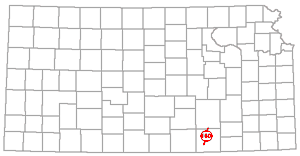 |
The name Winfield anticline is applied to an anticlinal fold, discernible in outcropping lower Permian rocks in central Cowley County.
According to Bass (1929, p. 121): "The Winfield anticline, which is about midway between the Dexter and 'granite ridge' folds, trends approximately parallel to them and is discernible in the surface beds. . . . The degree of dip of the surface beds is much less than in either of the other two folds, but like them this fold has the steeper dip on the east flank, and local constrictions divide it into a number of 'highs' separated by low structural saddles." The "granite ridge" is the Nemaha anticline.
Mapped by means of 50-foot contour lines with the upper surface of Mississippian rocks as datum, Bass (1929, pl. 11) showed the Winfield anticline extending from about sec. 14, T. 33 S., R. 4 E. northward to about sec. 31, T. 31 S., R. 5 E., but without closure.
Barwick, J.S. (1928) Salina basin of north-central Kansas: Am. Assoc. Petroleum Geologists Bull., vol. 12, no. 2, pp. 77-199, figs. 1-5.
Bass, N.W. (1926) Geologic investigations in western Kansas, with special reference to oil and gas possibilities: Kansas Geol. Survey, Bul. 11, pp. 1-96, figs. 1-27, pls. 1-9. [available online]
Bass, N.W. (1929) The geology of Cowley County, Kansas, with special reference to the occurrence of oil and gas: Kansas Geol. Survey, Bull. 12, pp. 1-203, figs. 1-23, pls. 1-12. [available online]
Bass, N.W. (1936) Origin of the shoestring sands of Greenwood and Butler Counties, Kansas: Kansas Geol. Survey, Bull. 23, pp. 1-135, figs. 1-10, pls. 1-21. [available online]
Beekly, A.L. (1929) Virgil pool, Greenwood County, Kansas: Am. Assoc. Petroleum Geologists, Structure of Typical Am. Oil Fields, vol. 2, pp. 142-149, figs. 1-4.
Berry, G.F., and Harper, P.A. (1948) Augusta field, Butler County, Kansas: Am. Assoc. Petroleum Geologists, Structure of Typical Am. Oil Fields, vol. 3, pp. 213-224, figs. 1-5.
Bunte, A.S., and Fortier, L.R. (1941) Nikkel pool, McPherson and Harvey Counties, Kansas: Am. Assoc. Petroleum Geologists, Stratigraphic Type Oil Fields, pp. 105-117, figs. 1-6.
Charles, H.H. (1927) Oil and gas resources of Anderson County, Kansas: Kansas Geol. Survey, Bull. 6, pt. 7, pp. 1-95, figs. 1-13, pls. 1-10. [available online]
Clair, J.R., and Edson F.C. (1950) Lithologic criteria of Arbuckle in western Kansas: World Oil, vol. 131, no. 7, pp. 83-84, 89-90.
Clark, G.C., and Cooper, C.L. (1927) Oil and gas in Oklahoma, Grant, Garfield and Nobel Counties: Oklahoma Geol. Survey, Bull. 40-H, pp. 1-44, figs. 1-11, pls. 1-6.
Clark, S.K., Arnett, C.L., and Royds, J.S. (1948) Geneseo uplift, Rice, Ellsworth, and McPherson Counties, Kansas: Am. Assoc. Petroleum Geologists, Structure of Typical Am. Oil Fields, vol. 3, pp. 225-248, figs. 1-17.
Clifton, R.L. (1926) Oil and gas in Oklahoma, Woods, Alfalfa, Harper, Major, Woodward, and Ellis Counties: Oklahoma Geol. Survey, Bull. 49-A, pp. 1-24.
Condra, G.E. (1927) The stratigraphy of the Pennsylvanian System in Nebraska: Nebraska Geol. Survey, Bull. 1, 2d ser., pp. 1-291, figs. 1-38, pl. 1-7.
Condra, G.E., and Bengston, N.A. (1915) The Pennsylvanian formations of southeastern Nebraska: Nebraska Acad. Sci. Pub., vol. 9, no. 2, pp. 1-60, pls. 1-21.
Condra, G.E., and Reed, E.C. (1943) The geological section of Nebraska: Nebraska Geol. Survey, Bull. 14, 2d ser., pp. 1-82, figs. 1-25.
Condra, G.E., and Upp, J.E. (1931) Correlation of the Big Blue Series in Nebraska: Nebraska Geol. Survey, Bull. 6, 2d ser., pp. 1-76, figs. 1-15.
Darton, N.H. (1905) Preliminary report on the geology and groundwater resources of the central Great Plains: U. S. Geol. Survey, Prof. Paper 32, pp. 1-433, figs. 1-18, pls. 1-72. [available online]
Darton, N.H.(1918) The structure of parts of the central Great Plains: U. S. Geol. Survey, Bull. 691, pp. 1-26, figs. 1-18, pl. 1. [available online]
Denison, A.R. (1926) Discussion of early Pennsylvanian sediments west of the Nemaha Granite Ridge, Kansas: Am. Assoc. Petroleum Geologists Bull., vol. 10, no. 6, p. 636.
Edson, F.C. (1947) Subsurface geologic cross section from Ford County, Kansas, to Dallam County, Texas: Kansas Geol. Survey, Oil and Gas Investi., Prelim. Cross Sec. 3. [available online]
Elias, M.K. (1931) The geology of Wallace County, Kansas: Kansas Geol. Survey, Bull. 18, pp. 1-254, figs. 1-7, pls. 1-42. [available online]
Fath, A.E. (1921) Geology of the Eldorado oil and gas field, Butler County, Kansas: Kansas Geol. Survey, Bull. 7, pp. 1-187, figs. 1-9, pls. 1-19. [available online]
Foster, W.H. (1929) Coffeyville oil field, Montgomery County, Kansas: Am. Assoc. Petroleum Geologists, Structure of Typical Am. Oil Fields, vol. 1, pp. 49-51, fig. 1.
Frye, J.C. (1940) A preliminary report on the water supply of the Meade artesian basin, Meade County, Kansas: Kansas Geol. Survey, Bull. 35, pp. 1-39, figs. 1-7, pis, 1-5. [available online]
Frye, J.C. (1950) Origin of Kansas Great Plains depressions: Kansas Geol. Survey, Bull. 86, pt. 1, pp. 1-20, figs. 1-2, pls. 1-4. [available online]
Frye, J.C., and Hibbard, C.W. (1941) Pliocene and Pleistocene stratigraphy and paleontology of the Meade basin, southwestern Kansas: Kansas Geol. Survey, Bull. 38, pt. 13, pp. 389-424, figs. 1-3, pls. 1-4. [available online]
Frye, J.C., and Schoff, S.L. (1942) Deep-seated solution in the Meade basin and vicinity, Kansas and Oklahoma: Am. Geophysical Union, Trans. of 1942, pp.35-39, figs. 1-3.
Fuenning, Paul (1942) Thickness and structural study of major divisions of Cretaceous System in Nebraska: Am. Assoc. Petroleum Geologists Bull., vol. 26, no. 9, pp. 1517-1536, figs. 1-10.
Haworth, Erasmus (1897) Underground waters of southwestern Kansas: U. S. Geol. Survey, Water-Supply Paper 6, pp. 1-65, figs. 1-2, pls. 1-12. [available online]
Hay, Robert (1883) The igneous rocks of Kansas: Kansas Acad. Sci. Trans., vol. 8, pp. 14-18.
Hintze, F.F. (1928) Discoverer of Gorham oil district, Kansas: Am. Assoc. Petroleum Geologists Bull., vol. 12, no. 4, p. 443.
Jewett, J.M. (1947) Review of oil and gas developments in Kansas: Mines Mag., vol. 37, no. 11, pp. 47-49, 81, fig. 1.
Jewett, J.M. (1948) Sub-surface aspects in Kansas water-flooding: World Oil, vol. 128, no. 8, pp. 142-144, 146, 149, 150, 152, figs. 1-3.
Jewett, J.M. (1949) Oil and gas in eastern Kansas with special reference to developments from 1944 to 1948: Kansas Geol. Survey, Bull. 77, pp. 1-308, figs. 1-53, pls. 1-4.
Jewett, J.M. (1950) Oil prospects in eastern Kansas: World Oil, vol. 130, no. 6, pp. 64-70, figs. 1-7.
Jewett, J.M., and Abernathy, G.E. (1945) Oil and gas in eastern Kansas: Kansas Geol. Survey, Bull. 57, pp. 1-244, figs. 1-21, pls. 1-4.
Jewett, J.M., and Newell, N.D. (1935) The geology of Wyandotte County, Kansas: Kansas Geol. Survey, Bull. 21, pt. 2, pp. 151-205, fig. 2, pls. 13-23. [Online]
Jewett, J.M., and Smith, R.K. (1949) Oil-bearing rocks in Kansas: Mines Mag., vol. 39, no. 12, pp. 85-91, figs. 1-3.
Johnson, W.D. (1901) The High Plains and their utilization: U. S. Geol. Survey, 21st. Ann. Rept., pt. 4, pp. 601-741, figs. 300-329, pls. 113-156. [Online]
Kellett, Betty (1932) Geologic cross section from western Missouri to western Kansas: Kansas Geol. Soc., Guidebook 6th Ann. Field Conf. (in pocket).
Knight, G.L., and Landes, K.K. (1932) Kansas laccoliths: Jour. Geology, vol. 40, no. 1, pp. 1-15, figs. 1-3.
Koester, E.A. (1934) Development of the oil and gas resources of Kansas in 1931 and 1932: Kansas Geol. Survey, Min. Res. Circ. 3, pp. 1-76.
Koester, E.A. (1935) Geology of Central Kansas uplift: Am. Assoc. Petroleum Geologists Bull., vol. 19, no. 10, pp. 1405-1426, figs. 1-5.
Lalicker, C.G. (1949) Principles of petroleum geology: Appleton-Century-Crofts, Inc., New York, pp. 1-377, figs. 1-157.
Landes, K.K. (1930) The geology of Mitchell and Osborne Counties, Kansas: Kansas Geol. Survey, Bull. 16, pp. 1-55, fig. 1, pls. 1-15. [available online]
Landes, K.K., and Ockerman, J.W. (1933) Origin of domes in Lincoln and Mitchell Counties, Kansas: Geol. Soc. America Bull., vol. 44, no. 6, pp. 529-540, figs. 1-3.
Latta, B.F. (1941) Geology and ground-water resources of Stanton County, Kansas: Kansas Geol. Survey, Bull. 37, pp. 1-119, figs. 1-6, pls. 1-9. [available online]
Latta, B.F. (1944) Geology and ground-water resources of Finney and Gray Counties, Kansas: Kansas Geol. Survey, Bull. 55, pp. 1-272, figs. 1-21, pls. 1-12. [Online]
Lee, Wallace (1939) Relation of thickness of Mississippian limestones in central and eastern Kansas to oil and gas deposits: Kansas Geol. Survey, Bull. 26, pp. 1-42, figs. 1-4, pls. 1-3. [available online]
Lee, Wallace (1941) Preliminary report on the McLouth gas and oil field, Jefferson and Leavenworth Counties, Kansas: Kansas Geol. Survey, Bull. 38, pt. 10, pp. 261-284, figs. 1-2, pls. 1-3. [available online]
Lee, Wallace (1943) The stratigraphy and structural development of the Forest City basin in Kansas: Kansas Geol. Survey, Bull. 51, pp. 1-142, figs. 1-22. [Online]
Lee, Wallace, Leatherock, Constance, and Botinelly, Theodore (1948) The stratigraphy and structural development of the Salina basin of Kansas: Kansas Geol. Survey, Bull. 74, pp. 1-155, figs. 1-11, pls. 1-14. [available online]
Lee, Wallace, and others (1946) Structural development of the Forest City basin of Missouri, Kansas, Iowa, and Nebraska: U. S. Geol. Survey, Oil and Gas Investi., Prelim. Map 48, sheets 1-7. [available online]
Lee, Wallace, and Payne, T.G. (1944) McLouth gas and oil field, Jefferson and Leavenworth Counties, Kansas: Kansas Geol. Survey, Bull. 53, pp. 1-195, figs. 1-20, pls. 1-10. [available online]
Ley, H.A. (1924) Subsurface observations in southeast Kansas: Am. Assoc. Petroleum Geologists Bull., vol. 8, no. 4, pp. 445-453.
Ley, H.A. (1926) The Granite Ridge of Kansas: Am. Assoc. Petroleum Geologists Bull., vol. 26, no. 1, pp. 95-96.
Lowman, S.W. (1933) Cherokee structural history in Oklahoma (Abstract): Tulsa Geol. Soc. Digest, pp. 31-34.
Lupton, C.T., Lee, Wallace, and Van Burgh, L.R. (1922) Oil possibilities of western Kansas: Am. Assoc. Petroleum Geologists Bull., vol. 6, no. 2, pp. 69-90, pls. 1-7.
McClellan, H.W. (1930) Subsurface distribution of pre-Mississippian rocks of Kansas and Oklahoma: Am. Assoc. Petroleum Geologists Bull., vol. 14, no. 12, pp. 1535-1556, figs. 1-3.
McCoy, A.W., and Keyte, W.R. (1934) Present interpretations of the structural theory for oil and gas migration and accumulation: Am. Assoc. Petroleum Geologists, Problems of Petroleum Geology, pp. 253-307, figs. 2-4.
McDowell, J.C. (1917) Geology in its relation to the oil industry: Am. Mining Congr., 19th Ann. Sess., Rept. of Proc., pp. 284-302.
McLaughlin, T.G. (1943) Geology and ground-water resources of Hamilton and Kearny Counties, Kansas: Kansas Geol. Survey, Bull. 40, pp. 1-220, figs. 1-18, pls. 1-17. [available online]
McNell, H.E. (1941) Wherry pool. Rice County, Kansas: Am. Assoc. Petroleum Geologists, Stratigraphic Type Oil Fields, pp. 118-138, figs. 1-8.
McQueen, H.S., and Greene, F.C. (1938) The geology of northwestern Missouri: Missouri Geol. Survey and Water Resources, vol. 25, 2d ser., pp. 1-217, figs. 1-11, pls. 1-7.
Maher, J.C., and Collins, J.B. (1948) Hugoton embayment of Anadarko basin in southwestern Kansas, southeastern Colorado, and Oklahoma panhandle: Am. Assoc. Petroleum Geologists Bull., vol. 32, no. 5, pp. 813-819, figs. 1-5.
Maher, J.C., and Collins, J.B. (1949) Pre-Pennsylvanian geology of southwestern Kansas, southeastern Colorado, and the Oklahoma panhandle: U. S. Geol. Survey, Oil and Gas Investi., Prelim. Map 101, sheets 1-4. [available online]
Moore, R.C. (1926) Early Pennsylvanian deposits west of the Nemaha granite ridge, Kansas: Am. Assoc. Petroleum Geologists Bull., vol. 10, no. 3, pp. 205-216, figs. 1-2, pl. 11.
Moore, R.C. (1936) Carboniferous rocks of North America: Rept. of the XVI International Geol. Congr., 1933, pp. 593-617, figs. 1-8, pls. 1-3.
Moore, R.C., and Boughton, C.W. (1921) Oil and gas resources of Kansas, Wilson and Montgomery Counties: Kansas Geol. Survey, Bull. 6, pt. 6, pp. 1-32, figs. 1-3, pls. 1-4. [available online]
Moore, R.C., and Haynes, W.P. (1917) Oil and gas resources of Kansas: Kansas Geol. Survey, Bull. 3, pp. 1-391, figs. 1-24, pls. 1-40. [available online]
Moore, R.C., and Jewett, J.M. (1942) Oil and gas fields of Kansas: Mines Mag., vol. 32, no. 10, pp. 481-488, 515-520, 526, 538, 560, figs. 1-12.
Moore, R.C. and Landes, K.K. (1927) Underground resources of Kansas: Kansas Geol. Survey, Bull. 13, pp. 1-154, figs. 1-115. [available online]
Moore, R.C. and Landes, K.K. (1937) Geologic map of Kansas: Kansas Geol. Survey, scale 1: 500,000.
Moore, R.C., and others (1951) The Kansas rock column: Kansas Geol. Survey, Bull. 89, pp. 1-132, figs. 1-52. [available online]
Morgan, L.C. (1932) Central Kansas uplift: Am. Assoc. Petroleum Geologists Bull., vol. 16, no. 5, pp. 483-484.
Moss, R.G. (1932) The geology of Ness and Hodgeman Counties, Kansas: Kansas Geol. Survey, Bull. 19, pp. 1-48, fig. 1, pls. 1-7. [Online]
Moss, R.G. (1933) Preliminary report on ground-water resources of the Shallow Water basin in Scott and Finney Counties, Kansas: Kansas Geol. Survey, Circ. 5, pp. 1-7, figs. 1-3. [available online]
Mudge, B.F. (1880) Metamorphic deposit in Woodson County: Kansas Acad. Sci. Trans., vol. 7, pp. 11-13.
Ockerman, J.W. (1935) Subsurface studies in northeastern Kansas: Kansas Geol. Survey, Bull. 20, pp. 1-78, figs. 1-4, pls. 1-13. [available online]
Pierce, W.G., and Courtier, W.H. (1938) Geology and coal resources of the southeastern Kansas coal field in Crawford, Cherokee, and Labette Counties: Kansas Geol. Survey, Bull. 24, pp. 1-122, figs. 1-13, pls. 1-12. [available online]
Prosser, C.S., and Beede, J.W. (1904) Description of the Cottonwood Falls quadrangle: U. S. Geol. Survey, Geol. Atlas of the U. S., Folio 109, pp. 1-6, figs. 1-2. [available online]
Rich, J.L. (1931) Source and date of accumulation of oil in granite ridge pools of Kansas and Oklahoma: Am. Assoc. Petroleum Geologists Bull., vol. 15, no. 12, pp. 1431-1452, figs. 1-3.
Rich, J.L. (1933) Distribution of oil pools in Kansas in relation to pre-Mississippian structure and areal geology: Am. Assoc. Petroleum Geologists Bull., vol. 17, no. 7, pp. 793-815, figs. 1-2.
Rubey, W.W., and Bass, N.W. (1925) The geology of Russell County, Kansas, with special reference to oil and gas resources: Kansas Geol. Survey, Bull. 10, pt. 1, pp. 1-86, figs. 1-11, pls. 1-7. [available online]
Russell, F.W. (1888) A crystalline rock near the surface in Pawnee Co., Neb.: Am. Geologist, vol. 1, pp. 130-131.
Rutledge, R.B., and Bryant, H.S. (1937) Cunningham field, Kingman and Pratt Counties, Kansas: Am. Assoc. Petroleum Geologists Bull., vol. 21, no. 4, pp. 500-524, figs. 1-5.
Shea, E.F. (1922) Water conditions in the Urschel pool, Marion County, Kansas: Am. Assoc. Petroleum Geologists Bull., vol. 6, no. 5, pp. 426-443, figs. 1-10.
Siebenthal, C.E. (1915) Origin of the zinc and lead deposits of the Joplin region: U. S. Geol. Survey, Bull. 606, pp. 1-283, figs. 1-16, pls. 1-11. [available online]
Smith, H.T.U. (1940) Geologic studies in southwestern Kansas: Kansas Geol. Survey, Bull. 34, pp. 1-244, figs. 1-22, pls. 1-34. [available online]
Smith, R.K., and Anders, E.L., Jr. (1951) The geology of the Davis Ranch oil pool, Wabaunsee County, Kansas: Kansas Geol. Survey, Bull. 90, pt. 2, pp. 13-52, figs. 1-6, pls. 1-2. [available online]
Smith, W.S.T., and Siebenthal, C.E. (1907) Joplin district folio, Missouri-Kansas: U. S. Geol. Survey, Geol. Atlas of the U. S., Folio 148, pp. 1-20, figs. 1-13. [available online]
Snow, D.R., and Dean, David (1929) Rainbow Bend field, Cowley County, Kansas: Am. Assoc. Petroleum Geologists, Structure of Typical Am. Oil Fields, vol. 1, pp. 52-59, figs. 1-2.
Stryker, W. L. (1925) Subsurface geology of Wilson County, Kansas: Am. Assoc. Petroleum Geologists Bull., vol. 9, no. 8, pp. 1207-1214, pl. 23.
Thomas, C.R. (1927) Flank production of the Nemaha mountains (granite ridge), Kansas: Am. Assoc. Petroleum Geologists Bull., vol. 11, no. 9, pp. 919-931, figs. 1-5.
Thomas, C.R. (1929) Flank production of the Nemaha mountains (granite ridge), Kansas: Am. Assoc. Petroleum Geologists, Structure of Typical Am. Oil Fields, vol. 1, pp. 60-72, figs. 1-5.
Twenhofel, W.H. (1927) Ordovician strata in deep wells of western central Kansas: Am. Assoc. Petroleum Geologists Bull., vol. 11, no. 1, pp. 49-53.
Twenhofel, W.H., and Bremer, Bernard (1928) An extension of the Rose dome intrusives, Kansas: Am. Assoc. Petroleum Geologists Bull., vol. 12, no. 7, pp. 757-762.
Twenhofel, W.H., and Edwards, E.C. (1921) The metamorphic rocks of Woodson County, Kansas: Am. Assoc. Petroleum Geologists Bull., vol. 5, pp. 64-74, fig. 1, pl. 11.
Udden, J.A. (1926) Occurrence of Ordovician sediments in western Kansas: Am. Assoc. Petroleum Geologists Bull., vol. 10, no. 6, pp. 634-635.
Ver Wiebe, W.A. (1930) Oil fields in the United States: McGraw-Hill Book Company, New York, pp. 1-629, figs. 1-230.
Ver Wiebe, W.A. (1930a) Ancestral Rocky Mountains: Am. Assoc. Petroleum Geologists Bull., vol. 14, no. 6, pp. 765-788, figs. 1-3.
Ver Wiebe, W.A. (1938) Oil and gas resources of western Kansas: Kansas Geol. Survey, Min. Res. Circ. 10, pp. 1-179.
Waite, H. A. (1947) Geology and ground-water resources of Scott County, Kansas: Kansas Geol. Survey, Bull. 66, pp. 1-216, figs. 1-16, pls. 1-16. [Online]
Walters, R. F. (1946) Buried Pre-Cambrian hills in northwestern Barton County, central Kansas: Am. Assoc. Petroleum Geologists Bull., vol. 30, no. 5, pp. 660-710, figs. 1-8.
Walters, R.F., and Price, A.S. (1948) Kraft-Prusa oil field. Barton County, Kansas: Am. Assoc. Petroleum Geologists, Structure of Typical Am. Oil Fields, vol. 3, pp. 249-280, figs. 1-7.
Wheeler, R. R. (1947) Anadarko basin, geology and oil possibilities: World Oil, vol. 127, no. 4, pp. 38-42, fig. 1.
Wilson, M. E. (1922) The occurrence of oil and gas in Missouri: Missouri Bur. Geology and Mines, vol. 16, 2d ser., pp. 1-284, pls. 1-11.
Wing, M. E. (1930) The geology of Cloud and Republic Counties, Kansas: Kansas Geol. Survey, Bull. 15, pp. 1-51, figs. 1-2, pls. 1-18. [Online]
Kansas Geological Survey, Geology
Placed on web July 15, 2005; originally published in 1951.
Comments to webadmin@kgs.ku.edu
The URL for this page is http://www.kgs.ku.edu/Publications/Bulletins/90_6/page3.html