![]()
Prev Page--Contents || Next Page--Stratigraphy
Introduction
General Statement
This report on the oil and gas resources of Anderson County, Kansas, was prepared from data secured by the writer while engaged in professional geologic work in that county. It is presented to give other geologists and the general public detailed information on some of the shallow oil and gas fields of eastern Kansas, particularly those of the well-known "shoestring" type. These shallow fields are of only slight economic importance as compared with other fields of the Midcontinent region. For this reason, and because of the lack of dependency that can be placed on the application in this area of the methods commonly employed for discovering oil and gas, they have received only passing notice from the geologic profession. However, the scientific importance of these fields, if measured in the interest they arouse, is of the highest order. The writer hopes that the interest and pleasure which their study has afforded him may be passed on to others through the medium of this report.
Acknowledgments
Acknowledgments are made to the many people whose combined contributions of advice and information are represented in this work. To Mr. Edgar W. Owen, with whom the writer was associated for two years, is due special credit for reviewing the manuscript and contributing many constructive suggestions and criticisms. Dr. John L. Rich very kindly furnished helpful ideas induced by his long experience in the "shoestring" fields. Dr. R. C. Moore, state geologist, and Dr. Kenneth K. Landes, acting state geologist, gave valuable assistance in keeping with their offices. Other geologists who helped through discussions and data and whom the writer wishes to thank are Mr. J. M. Lilligren, Mr. H. E. Crum, Mr. J. H. Page, Mr. E. L. Bradley, and Mr. J. W. Polkinghorn. The former employers of the writer, Mr. A. H. Keys, of Oklahoma City, Okla., and Mr. D. D. Richards, of Garnett, Kan., are due special thanks for permission to use the detailed information included in this report and collected at considerable expense to them. The writer wishes to acknowledge the help given him by the operators, production superintendents, and drilling contractors, who always responded generously to requests for information. Among these are Mr. John C. Keys, Mr. H. C. Cooper, Mr. Fred L. Denton, Mr. J. C. Hart, Mr. W. T. Stroud, Mr. T. W. Reid, Mr. H. C. Harris, Mr. D. D. Nolan, Mr. W. S. Fees, Mr. J. L. Kleckner, Mr. Frank Jack, Mr. T. G. Adams, Monitor Oil & Gas Company, J. B. Kirk Gas & Smelting Company, Southwestern Petroleum Company through Mr. B. F. Brundred, and the Teton Syndicate through Mr. Robert Green. Acknowledgment is made to Mr. F. Scott Tarbell for the use of his county production map as a base for the one accompanying this report.
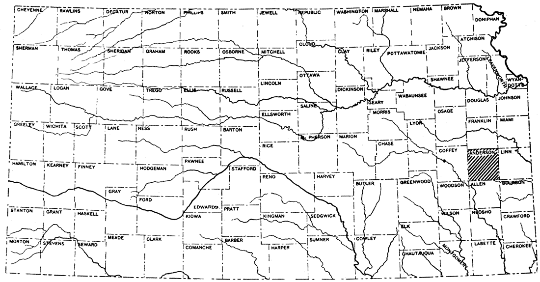
Figure 1—Index map of Kansas showing location of Anderson County.
Location and Culture
Anderson County is in the middle-eastern part of Kansas, approximately 25 miles from the Missouri state line. The county is made up of 576 sections, which form a block 24 miles square.
Anderson County is devoted primarily to agriculture and stock raising. The important crops are native hay, corn, wheat, and oats. Pastures and hay-meadows comprise large areas of the rougher uplands.
The three principal towns, Garnett, Colony and Greeley, are within the narrow belt of oil- and gas-producing territory which extends northeast-southwest through the county. Garnett, the county seat, has a population of about 2,500. It is typical of an agricultural town rather than an oil town. Colony, in and near which there was formerly large gas production, is a village of about 1,000 inhabitants in the southern part of the county. Greeley, another small village, is 10 miles northeast of Garnett.
The southern Kansas branch of the Atchison, Topeka & Santa Fe railway extends north-south through the county. The Kansas City-Little Rock line and two minor branches of the Missouri Pacific traverse the county from east to west. A main line of the Missouri-Kansas-Texas system crosses the southeastern corner.
The highways follow the section lines except where unusual topographic features force them from their direct courses. Clay roads, the predominating type, are kept well graded and in generally good condition when the weather is favorable, but they become uninviting to traffic during the rainy seasons. A few of the main roads have been improved with chert gravel and are readily passable during all seasons.
Topography and Drainage
Anderson County lies in an area of rather deeply-dissected plains. The chief topographic features are east-facing escarpments and broad intervening slopes. The escarpments are capped by the Iola and Plattsburg-Stanton limestones and hard sandstone members of the Lawrence shale. With many deviations they follow the strike of the rocks. The scarps can be traced for long distances in parts of the county, but in others they are covered by clay and gravel and merge into rolling, featureless hills. Less prominent rolling hills are characteristic of the areas underlain by shale. Outliers of resistant beds are numerous. Where the major streams have cut through the hard beds the valley walls are bluffs 100 to 150 feet high. In the large valleys the streams have developed flood plains and flow in meandering courses across them.
The elevation ranges from 1,200 feet at points in the eastern part of the county to 850 feet in the valley of Pottawatomie creek in the northern part. The average elevation is about 1,050 feet.
Pottawatomie creek is the major stream. It and numerous tributaries which drain the northern two-thirds of the county flow eastward and northeastward and leave the county near the northeastern corner. South Pottawatomie rises two miles east of Welda, flows northward four miles and then takes a northeast course past Garnett to finally enter main Pottawatomie a mile northwest of Greeley. Cedar creek has its source southwest of Welda, flows northeastward, and enters Pottawatomie creek three miles north of Garnett. The southern part of the county is drained by streams flowing southward and southwestward. All except the larger streams are dry during the summer months.
History of Oil and Gas Development
The first well put down for oil or gas was drilled about 1885 on the John Neville farm in the SW sec. 6, T. 20 S., R. 20 E. This well is reported to have had a good showing of oil but it was not completed as a commercial well because gas was being prospected for at the time. Another of the very early wells was drilled on the Henry Doering farm in the SE sec. 19, T. 20 S., R. 20 E. It encountered a small flow of gas but was abandoned at about 500 feet. Only a few scattered wells were put down during the next several years.
The first activity of importance took place after the discovery of gas a mile southeast of Garnett in 1904. Mr. Fred Ball was the operator who opened this field. He sold his interests to the Garnett Gas Company, which in turn was taken over by the Garnett Light & Fuel Company. Each of these operators supplied gas to the city of Garnett. As the wells near town became exhausted prospecting was carried northeastward down the valley of South Pottawatomie creek. Both oil and gas were found in a narrow, discontinuous belt from Garnett to Greeley. The most recent development in the belt is the gas field discovered one and a half miles south of Greeley in 1923.
The southern part of Anderson County remained unexplored until the summer of 1921. At that time the first gas well was drilled in the Colony gas field. An extensive drilling campaign resulted from this discovery. Within 18 months an unbroken strip of oil- and gas-producing territory 12 miles long was opened from Colony to a point near Mont Ida. In September, 1921, the first well of the Garnett oil shoestring came in. This narrow field has been extended westward to a point where the sand does not contain gas, oil, or water. The last but most important field in Anderson County is the Bush City shoestring. The first well was brought in during March, 1923. Three and a half years were occupied in drilling up this trend, which proved to be a rich shoestring extending 14 miles through the county. A few small gas pools were opened up while the major part of the development was taking place.
Many wildcat wells were drilled from 1921 to 1927, the majority within four or five miles of the present productive territory. About 2,467 wells have been drilled in the county to date (January 1, 1927), of which 816, or 33 per cent, are dry holes; 518, or 21 per cent, are gas wells or abandoned gas wells; and 1,133, or 46 per cent, are oil wells or abandoned oil wells. [These figures include the wells on the production map accompanying this report. Shallow gas wells at Greeley and all the town-lot wells at Colony could not be shown. A few of the oldest wells may not be represented, but almost every well drilled during the last five years is accounted for. The percentage date may be considered to be very nearly correct.]
Prev Page--Contents || Next Page--Stratigraphy
Kansas Geological Survey, Geology
Placed on web Feb. 6, 2018; originally published June 15, 1927.
Comments to webadmin@kgs.ku.edu
The URL for this page is http://www.kgs.ku.edu/Publications/Bulletins/6_7/02_intro.html