![]()
Use your "Back..." command to return...
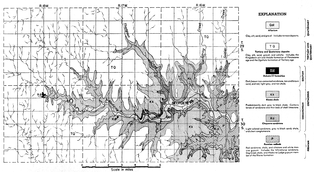
Figure 3
Fig. 3--Geologic map of the Belvidere area, Kansas.
Use your "Back..." command to return...
Kansas Geological Survey, Geology
Placed on web Aug. 28, 2007; originally published December 1946.
Comments to webadmin@kgs.ku.edu
The URL for this page is http://www.kgs.ku.edu/Publications/Bulletins/64_6/fig3.html