![]()
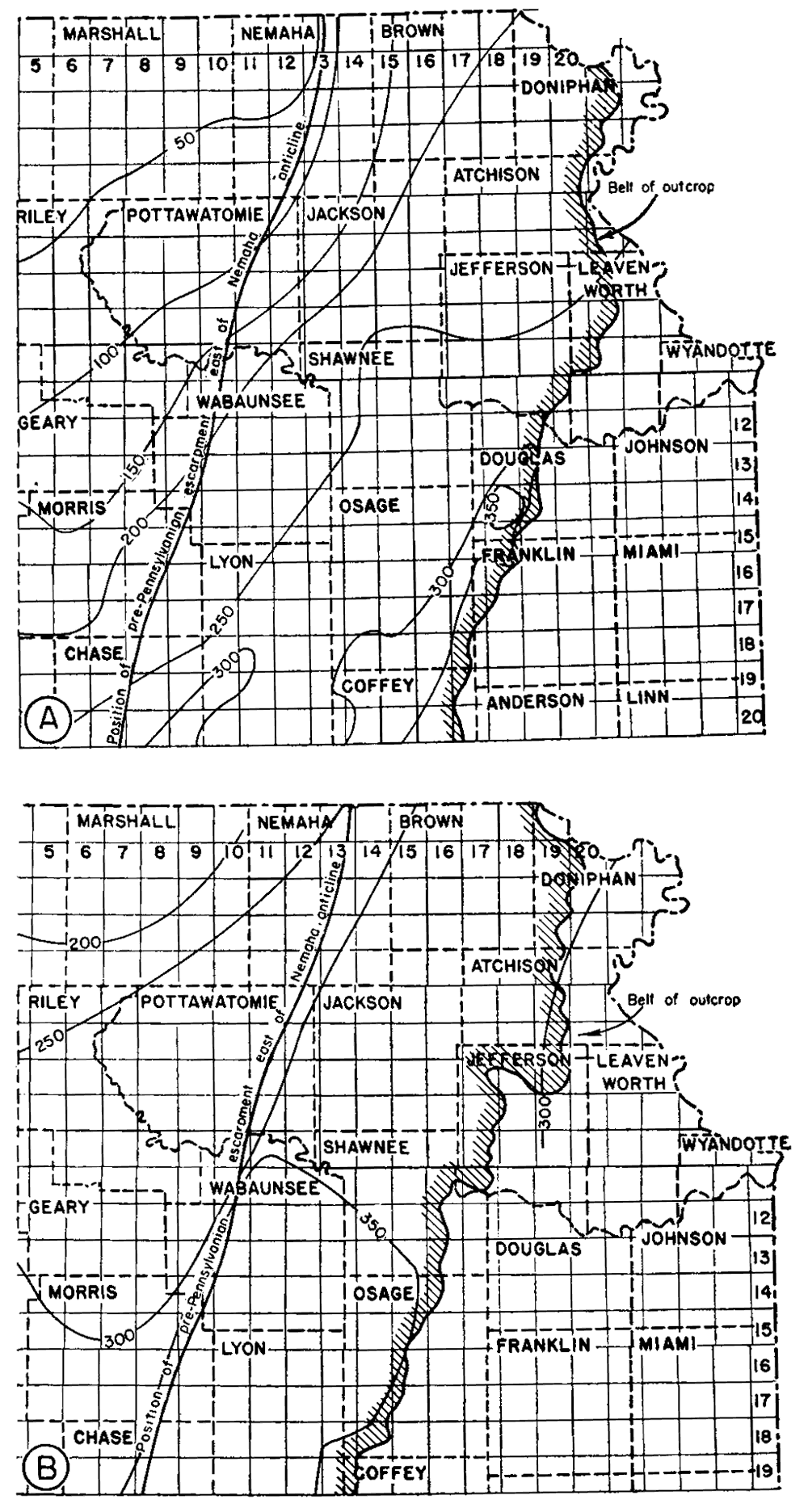
Figure 18--Maps of northeastern Kansas showing thickness of (A) rocks between the top of the Lansing group and the base of the Shawnee group, and (B) rocks of Shawnee age. Isopachus lines connecting points of equal thickness are drawn at intervals of 50 ft.
Kansas Geological Survey, Forest City Basin
Comments to webadmin@kgs.ku.edu
Web version July 2005. Original publication date Dec. 1943.
URL=http://www.kgs.ku.edu/Publications/Bulletins/51/fig18.html