![]()
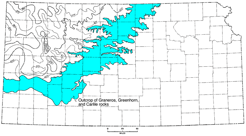
Figure 21
Figure 21--Isopachus map from base of Fort Hays Limestone to top of Dakota; interval includes Carlile, Greenhorn, and Graneros Formations. Maximum thickness is in western Gove County. Contour interval 25 feet.
Kansas Geological Survey, Geologic History of Kansas
Comments to webadmin@kgs.ku.edu
Web version April 2006. Original publication date Dec. 1963.
URL=http://www.kgs.ku.edu/Publications/Bulletins/162/fig021.html