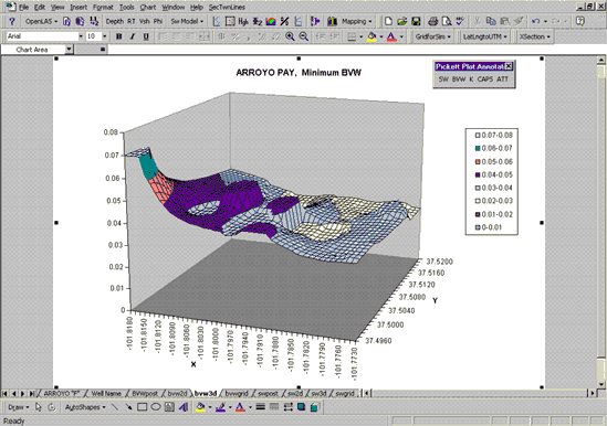
FIGURE 2.14. The PfEFFER 2.0 Mapping module produces a "first-look" map to examine spatial variability/continuity among wells, assess reservoir heterogeneity, and evaluate the consistency of the variables being mapped. The "mapping" or project workbook is electronically linked to "well" workbooks and associated "reservoir" worksheets. Information changed in a reservoir worksheet level is reflected in the mapping workbook. Griding, base map generation, 2-D and 3-D visualization of the parameters are accomplished automatically