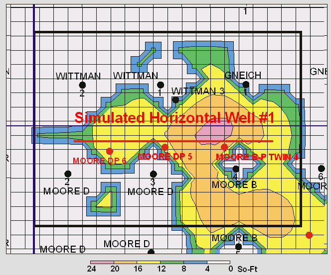
FIGURE 2.12. Remaining hydrocarbon saturation-feet map with possible vertical and horizontal infill locations base on the reservoir characterization and simulation at Schaben Field.