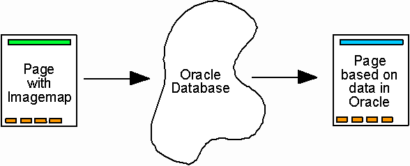
Figure 13. Instead of presenting an existing web page, the imagemap can call a database. The database can be used to create a web page based on the parameters sent and the data currently stored in the database. By clicking on section 36 in Figure 9 the user were generate the following commands and parameters:
<area shape=rect coords="408,54,478,124" href="http://magellan.kgs.ku.edu/abyss/public/ dpa.chase.mainTRS?twn=18&rge=10&sct=36">,
and would produce the output shown in Figure 10.