


Kansas Geological Survey, Open File Report 98-48
GEMS Site Borehole GPR, continued
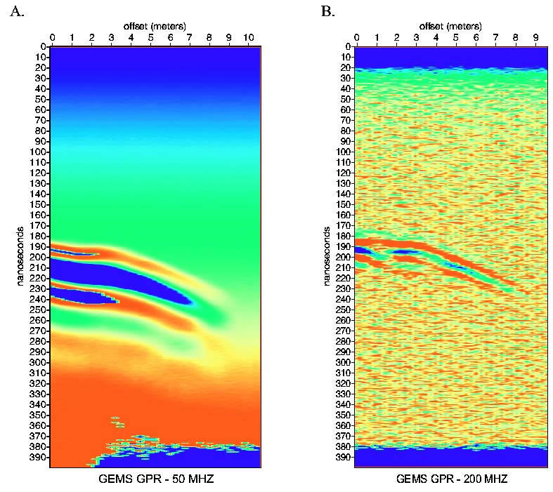
Figure 8
Survey 2 GPR common-source gathers using (a) 50 MHz, and (b)
200 MHz, borehole antenna. The vertical axis is one-way travel-time in
nanoseconds, and the horizontal axis is vertical distance between source
and receiver antennas. Source depth locations were 20.5 m. The
antennas were 9.66 m apart at zero-offset.
A small version of this figure is available.
Back to report start
Kansas Geological Survey, Oil and Gas Information
Updated Nov. 17, 1998
Comments to webadmin@kgs.ku.edu
The URL for this page is HTTP://www.kgs.ku.edu/PRS/publication/OFR98_48/fig8.html