|
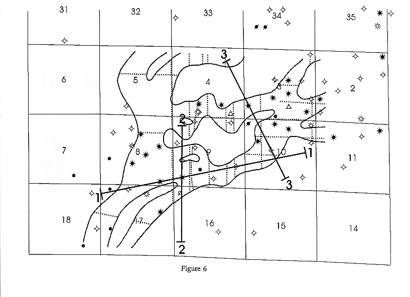
| Figure 6. Location map with "channel" locations interpreted from seismic anomalies located on previously acquired seismic data. Solid lines indicate anomaly (channel) boundaries and dotted lines indicate location of seismic lines with anomalies. Most of the seismic data used for this interpretation were acquired with a vibrator source with frequencies after processing below 100 Hz. Seismic lines acquired in this study are also indicated. Note that line 1 runs along a channel while lines 2 and 3 cross one or more channels. |