|
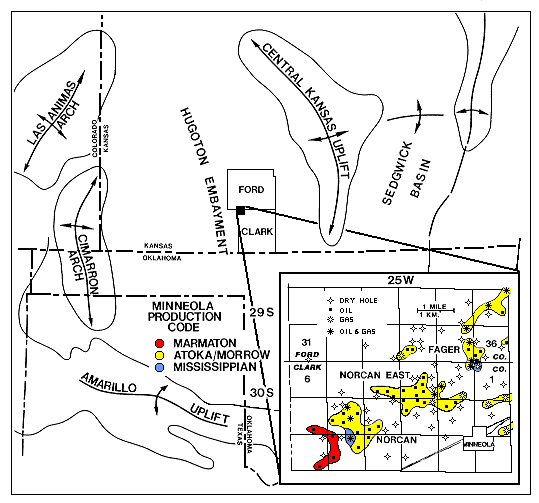
| Figure 1. Regional map showing location of the Minneola complex of oil and gas fields in relation to surrounding uplifts and basins (modified from Clark, 1987). Also indicated are productive horizons. The seismic data for this study were acquired over the Norcan and Norcan East fields in T30S, R25W of Clark County. |
e-mail : webadmin@kgs.ku.edu
Updated January 1999
The URL for this page is http://www.kgs.ku.edu/PRS/publication/OFR98_44/44-fig1.html