![]()
![]()
![]()
Kansas Geological Survey, Open File Report 97-14
Digital Petroleum Atlas Annual Report 1996
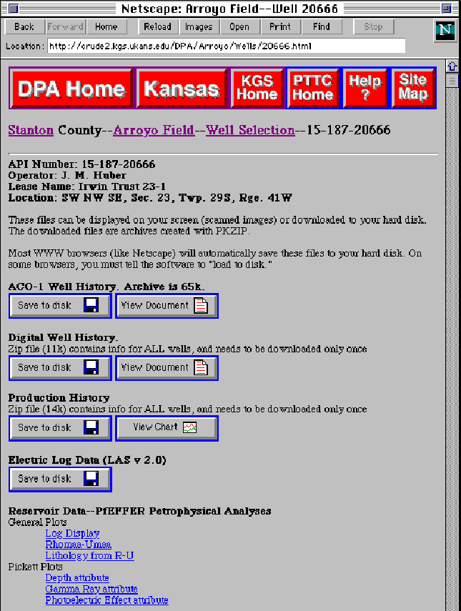
Figure 11. Individual well data page for a selected well in the Arroyo Field, Stanton County, Kansas (http://www.kgs.ku.edu/DPA/Arroyo/Wells/20666.html). Data includes a raster image of the original completion report (ACO-1), digital well data (including geologic mapping horizons), production data, electric log data (LAS format), and other reservoir data associated with the individual well. Well data can be accessed by clicking on the well spot on the field map, by searching on API number, or through a township-range-section search.