Various geophysical and geologic methods have been used to image the shallow subsurface (0-100 m). These methods used in conjunction with a modified computerized interpretation system include high-resolution seismic reflection (2-D and 3-D), vertical seismic profiling (VSP), ground-penetrating radar (GPR), and color image transformation and treatment of the transformed wireline log data as "seismic" traces (pseudo-seismic). The computer workstation approach allows efficient, detailed, and integrated studies to be performed at these sites.
Examples from throughout Kansas involving a variety of environmental questions and problems associated with salt dissolution are used to illustrate the utility of using the computer workstation in the study of environmental geology.
Key words: computer workstations, environmental geology, Permian salts, geophysical data.
Adequate understanding of heterogeneities of near subsurface geology is an important component to improved site investigations, avoidance of excess spending and ineffective remediation. Environmental investigations have focused on the point data obtained from the drill rig. Point data is often inadequate for understanding preferential flow pathways and variations in relative permeability. Near-surface computer-aided geophysical and geologic methods are another way to image the subsurface. Application of computer-aided visualization and analysis systems in conjunction with the use of near-surface geophysical and geologic methods can provide detailed information of subsurface structures that affect fluid flow direction and rate of fluid movement and enhance containment and remediation procedures.
This paper presents projects underway in Kansas that involve the application of geophysical and geological methods and the computer workstation to a variety of environmental questions and problems associated with salt dissolution. Permian salts present in the shallow subsurface of the central and southern parts of Kansas result in a number of environmental problems ranging from large-scale contamination of entire aquifers, to localized dissolution collapse features. Causation is a complex interaction of natural processes and anthropogenic activities (e.g., irrigation and oil field activities). Examples from Kansas illustrate the utility of the computer workstation to perform integrated studies of environmental problems at scales ranging from small-scale site investigation to regional aquifer studies. Data were collected as part of ongoing studies of ground water aquifers in Kansas by the Kansas Geological Survey.
Various geophysical methods were used at several site investigations to image the geology of the shallow subsurface (0-100 m). These methods include high-resolution seismic reflection (2-D and 3-D), vertical seismic profiling (VSP), and ground-penetrating radar (GPR). These geophysical methods along with subsurface geologic data are used in conjunction with a computerized interpretation system. The system allows efficient, detailed and integrated studies to be performed at these sites.
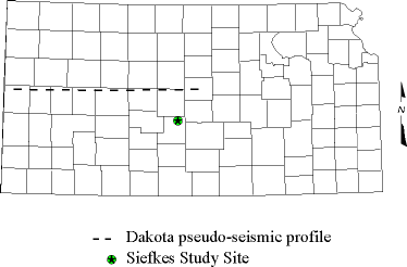
In order to undertake a regional aquifer study, a new application of computer workstation-based interpretational software was developed. This application treats transformed wireline log data as "seismic" traces for the purposes of processing, interpretation and display. A color image transformation can combine data from selected wireline logging tools to generate a color coded "crossplot log" for each well. A well-designed transformation can provide an image of the spatial distribution of subsurface lithology or fluids. The transformed image, in either 2-D or 3-D, can be treated on the workstation as "seismic" data, easing the data handling burdens through use of computerized techniques designed for interpretation of seismic data.