Kansas Geological Survey, Open-file Report 2004-39
Index of Images || Small Web Image || Acrobat PDF (659K)
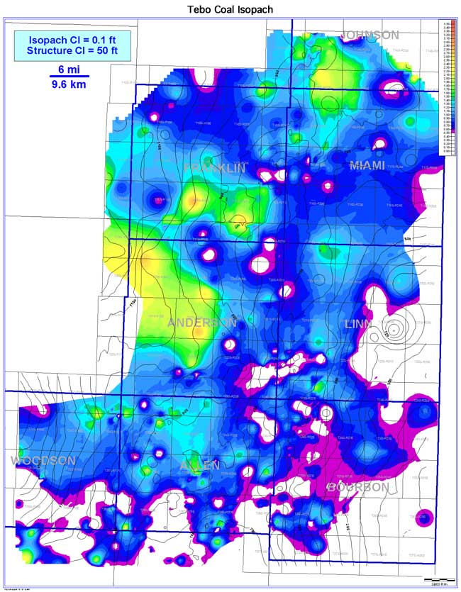
The Tebo coal exhibits lenticular coal-seam geometry oriented roughly parallel to regional depositional strike (NW-SE). Coal extent is estimated to be 3,841 sq mi (9,948 sq km) while continuity is 1,526 sq mi (3,952 sq km [39.7%]). The coal is more continuous and better developed over and eastward of the underlying Weir-Pittsburg coal. The Tebo pinches out in the far eastward portion of the study area (southeastern Linn and Bourbon counties). Coal thickness across the Bourbon arch ranges from 0 to 2.8 ft (0 to 0.9 m), averaging 0.8 ft (0.3 m). Consistently thicker coal trends occur in Anderson, Franklin, northern Miami, and southern Johnson counties. As with the Weir-Pittsburg coal, absence of the Tebo is due to either nondeposition or overlying channel incision. No correlation is evident when the Tebo coal isopach map is superimposed with the structure contour map of the base of the coal.