 |
Detailed mapping of the Upper Hutchinson Salt and Overlying Permian
strata beneath Hutchinson, Kansas
|
Kansas Geological Survey
Open-file Report 2003-66 |
Figure 7
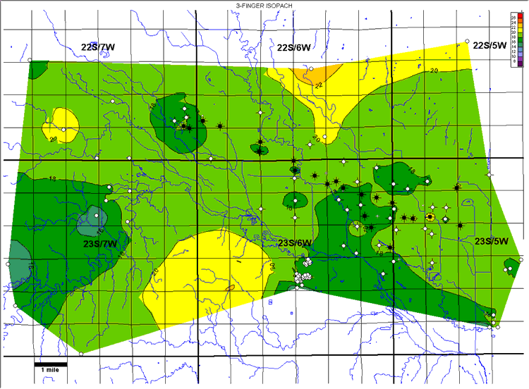 |
| Figure 7A. Isopach map of the 3-finger dolomite interval. Contour interval
= 2 ft. . |
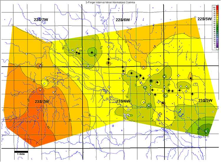 |
| Figure 7B. Mean normalized natural-gamma ray for the 3-finger dolomite
interval. Values are % shale. Contour interval = 5%. |
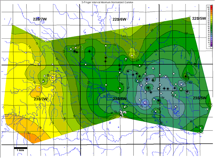 |
| Figure 7C. Minimum normalized natural-gamma ray for the 3-finger dolomite
interval. Values are % shale. Contour interval = 5%. |
Wells within the study area not used in generating these maps are displayed
in gray at half size.
e-mail : webadmin@kgs.ku.edu
Last updated December 2003
http://www.kgs.ku.edu/PRS/publication/2003/ofr2003-66/figure7.html