 |
|
Kansas Geological Survey Open-file Report 2003-66 |
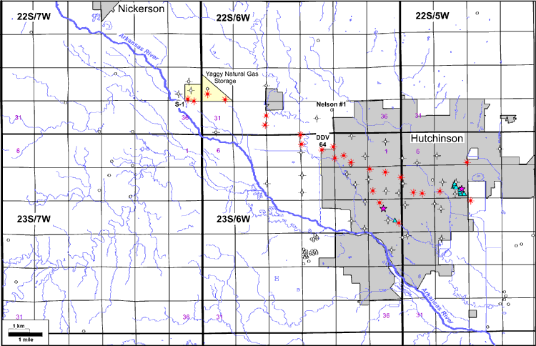
Figure 1. Base map of the study area. Locations of gas geysers are shown by blue triangles, and explosion sites are indicated by magenta stars. Observation and vent wells that vented natural gas are indicated by a red producing-well symbol. Vent wells that did not produce gas are indicated by a dry-hole symbol. Additional wells used for log correlations are shown with an open circle.
e-mail : webadmin@kgs.ku.edu
Last updated December 2003
http://www.kgs.ku.edu/PRS/publication/2003/ofr2003-66/figure1.html