 |
|
Kansas Geological Survey Open-file Report 2003-30 |
General Geology
Panoma Field
The most striking large-scale geometry feature of the Panoma reservoir is the reciprocal relationship between nonmarine and marine interval thickness. Though the total thickness of the Council Grove (A1-B5) in most of the study area varies less than 50 feet (from 200-250 feet), the summed nonmarine and marine intervals each vary 120 feet (from 50-170 feet) and their respective summed thicknesses are reciprocal. Thick nonmarine shale and silt dominates the northwest side of the study area while marine carbonates dominate to the southeast.
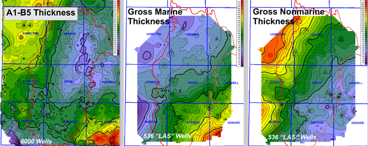
Maps of the A1SH (top Council Grove) through the B5LM (base Cottonwood)
Strat X-Sections
Northwest to southeast cross sections illustrate the large-scale lithofacies and depositional relationships in the Panoma Field. The updip limit to the Panoma coincides with thinned marine carbonate intervals and their reciprocally thicker nonmarine silts and shaly silts. The smaller scale cross section of the same wells shows the 8 lithofacies using Petrel's interpretive colorfill. It illustrates some major lateral and vertical facies relationships but is not to be considered a true representation of the finer geometries.
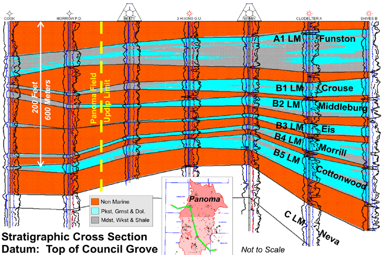
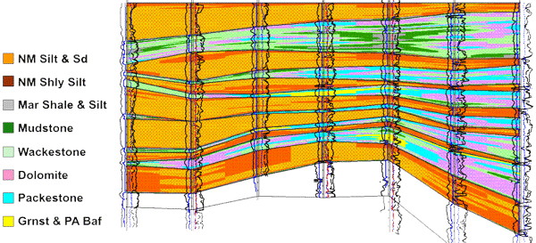
Lithofacies are those predicted by neural net models (see Panel 3) in wells without triangles around the well symbols. Lithofacies by core description are shown in wells with triangles which are two of the eight ‘keystone wells.”
Maps and cross sections in this panel were created in geoPLUS Petra with an academic license
|
|
|
e-mail : webadmin@kgs.ku.edu
Last updated May 2003
http://www.kgs.ku.edu/PRS/publication/2003/ofr2003-30/P1-05.html