 |
|
Kansas Geological Survey Open-file Report 2003-29 |
Stratigraphic Cross Section
Datum: Top of Council Grove
Strat X-Sections
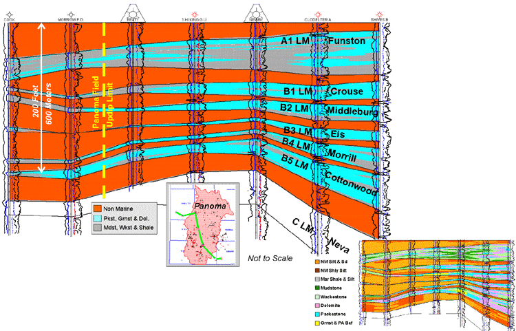
Northwest to southeast cross sections illustrate the large-scale lithofacies and depositional relationships in the Panoma Field. The updip limit to the Panoma coincides with thinned marine carbonate intervals and their reciprocally thicker nonmarine silts and shaly silts. The smaller scale cross section of the same wells shows the 8 lithofacies using Petrel's interpretive colorfill. It illustrates some major lateral and vertical facies relationships but is not to be considered a true representation of the finer geometries.
|
|
|
e-mail : webadmin@kgs.ku.edu
Last updated May 2003
http://www.kgs.ku.edu/PRS/publication/2003/ofr2003-29/P3-02.html