 |
|
Kansas Geological Survey Open-file Report 2003-29 |
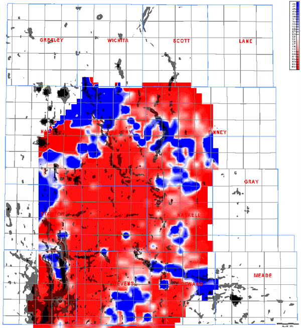
Hugoton Water Production on Test |
 |
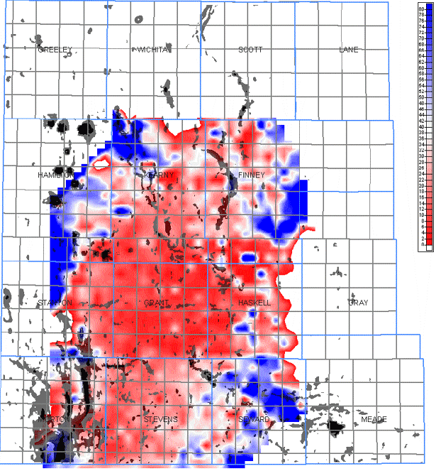
Hugoton Final Shut in Pressure |
 |
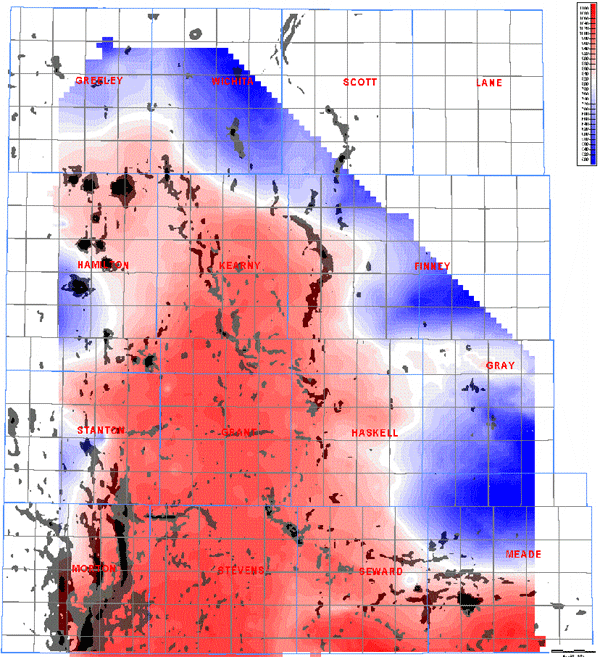
Hugoton Gas BTU Values |
 |
Joining Digital Reservoir and Geologic Data
As prorated fields, each well in the Hugoton and Panoma fields is tested every other year (alternating sections each year). Test results are available through the Kansas Corporation Commission. Proration test data along with production data have been linked to individual wells. Maps of parameters such as shut-in pressure, water production on test and annual production (all data calendar year 2001) illustrate variations across the Hugoton. An overlay extracted from the change in slope map on top of the Fort Riley Limestone Member shows the highest changes in slope. Linear trends of high slope changes are interpreted as possible faults. These “fault” trends appear to coincide with changes in reservoir parameters within the reservoir units of both the Chase and Council Grove groups. The data base developed though the Hugoton project can be queried to produce similar maps for any horizon and can be joined with production, test and other geologic and reservoir data for selected years or for multi-year time periods.
Several thousand gas analyses have been associated with individual wells. A map of BTU value of produced gas from the Hugoton Field (Chase) has been gridded (2640 foot, 806m grid). An overlay of maximum change in slope on top of the Fort Riley Limestone Member has been overlain. The probable faults appear to compartmentalize the Hugoton (Chase) reservoir resulting in changes in BTU values across slope anomalies.
|
|
|
e-mail : webadmin@kgs.ku.edu
Last updated May 2003
http://www.kgs.ku.edu/PRS/publication/2003/ofr2003-29/P2-03.html