 |
|
Kansas Geological Survey Open-file Report 2003-29 |
Structure on Top of Fort Riley
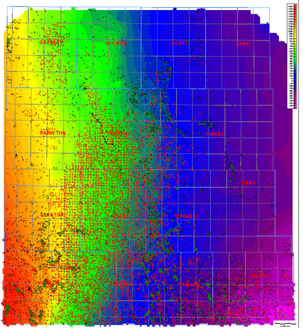
A total of 14,142 horizon picks on the top of the Fort Riley Limestone Member of the Barneston Limestone (Chase Group) were used to generate a structure map (2640 foot, 806m grid). The structure contour map displays the regional tilt to the east and south characteristic of all the upper Paleozoic horizons in western Kansas, which was the product of earlier depositional patterns and the later Laramide orogeny. Local structures such as the Keyes Dome in extreme southwest Kansas and the small-scale northwest-southeast ridge-like structures can be recognized. Map squares are townships (6 miles [10 km]).
Fort Riley Slope Map
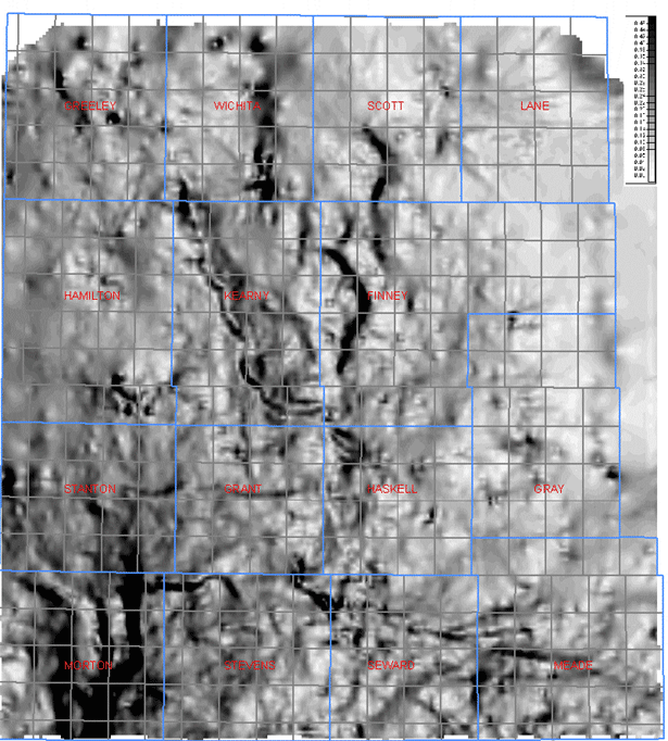
The grid for the structure on top of Fort Riley Limestone (2640 foot, 806m grid) is used to generate a curvature map (slope). Higher slope between grid nodes is highlighted in darker shades of gray. Linear trends of relatively higher slope among multiple grid nodes are indicative of structural features (e.g., faults). The eastern border of the Keyes Dome is defined by a series of north-south linear anomalies that are interpreted as down to the east faults. A number of northwest linear features cut across the Hugoton Embayment and appear to influence production trends in the shallower Permian gas fields and the deeper Carboniferous oil and gas pools. A circular trend centered on Meade County, Kansas is interpreted as the intersection of northeast-southwest faults that are cut and offset by the northwest-southeast fault sets. Deeper oil and gas production in the Meade County area is largely confined to the area south of the circular trend.
Structure Top of Fort Riley Limestone |
 |
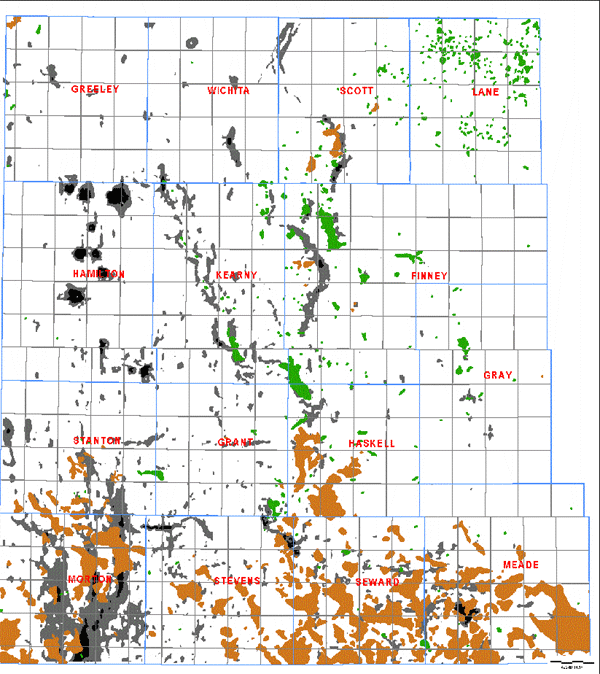
Hugoton "Deep" Oil & Gas Fields |
 |
 |
|
|
|
e-mail : webadmin@kgs.ku.edu
Last updated May 2003
http://www.kgs.ku.edu/PRS/publication/2003/ofr2003-29/P2-01.html