


Kansas Geological Survey, Open File Report 96-51
- Color maps, "relief" created by vertical illumination, with overlays of...
- County Lines Only ||
Oil and Gas Fields ||
Post-Mississippian Structure ||
Regional Precambrian Structure
- Top of the Precambrian ||
Regional lineations ||
Local lineations
- Color maps with overlays of...
- County Lines Only ||
Oil and Gas Fields ||
Top of the Precambrian ||
Regional lineations ||
Local lineations
- Black and white maps, "relief" created by vertical illumination,
with overlays of...
- County Lines Only ||
Oil and Gas Fields
- Maps showing...
- Regional lineations, oil and gas fields ||
Local lineations, oil and gas fields
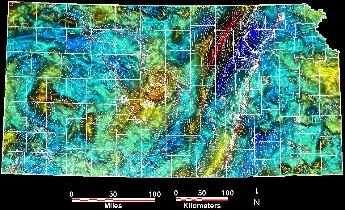
Contour interval 100 ft., sea level datum.
Contours = white, faults = red.
See Regional Precambrian Structure map for regional
contour values every 1000 ft.
Overlay based on
Cole, V.B., 1976, Configuration of the top of Precambrian rocks in Kansas:
Kansas Geological Survey, Map M-7, scale 1:500,000.
Kansas Geological Survey, Petroleum Research Section
Updated March 19, 1997
Please send comments to webadmin@kgs.ku.edu
URL is HTTP://www.kgs.ku.edu/PRS/PotenFld/grav/coleMed.html